Before a detailed 25-inch Ordnance Survey map of Ilkeston was drawn up in 1879-1880 there were several other maps made of the town … some more useful than others.
————————————————————————————————————————————————————————
1… Fletcher’s map of the Manor of Ilkeston, 1598
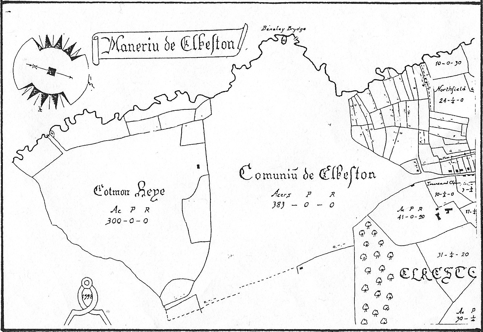
Above is the northern section of Henry Fletcher’s map of the ‘Manor of Ilkeston’ of 1598. I hope that you can see the amount of detail it contained.
2 … Gauntley’s map of land ownership, 1795
In the Eighteenth century, from the bottom of Bath Street up to Church Street, and from Heanor Road across to the Erewash river, we find Ilkeston Common. This was one large and continuous area of grazing land where owners of copyhold and freehold land had a right to graze their animals, in proportion to how much land they controlled. These grazing rights could be bought and sold, and it had long been like this. The Enclosure Movement involved taking the Common land and dividing it up into individual private plots, eventually with walls and fences around each.
In Ilkeston, this process took place at the very end of the Eighteenth century as these two ‘adverts‘ from the Derby Mercury show
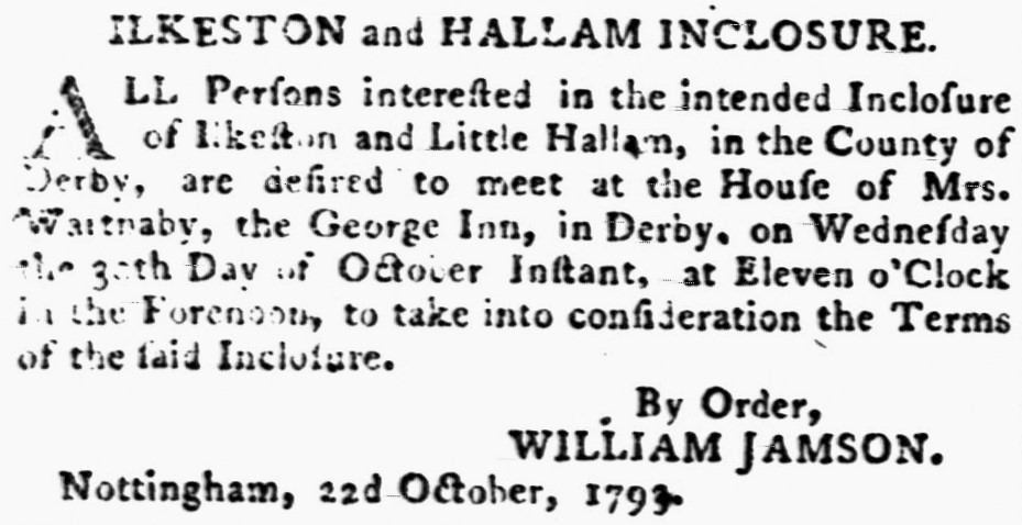
(The House of Mr. Cocker, mentioned in the second article was the Manor House at the bottom of Bath Street.)
William Gauntley, surveyor to the Duke of Rutland, produced his map of land ownership in 1795. Each holding or parcel was numbered, and you can find examples taken from that map at other parts of the site. Below is the part showing the Heanor Road with what is now Granby Street branching off it.
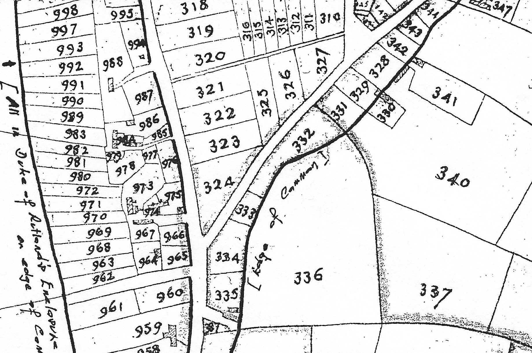
3…. Gauntley’s Enclosure Award map of 1798
Just a few years later in 1798, at the time of the Enclosure of Ilkeston Common, William Gauntley produced a second map, very similar to the 1795 map, but with the parcels ‘numbered’ differently. The northern part is shown below. I leave you to identify the routes shown.
4 … Copyhold surveys
There were two further surveys of copyhold property in 1817 and 1849, before the ‘Local Board Map’ of 1866.
—————————————————————————————————————————-
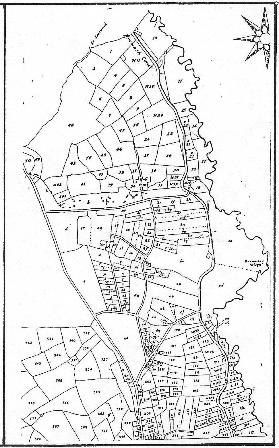
5 …. The Local Board Map of Ilkeston 1866
This is the map which will help us as we begin our examination of the early years of Ilkeston’s schools and its education system. It arose out of the work of the central government. Not perfect but important, the 1848 Public Health Act gave some boroughs limited powers over drainage and sewerage, sanitation, waste removal, water and medical provision.
Also, in Section XLI (41) of the Act, it was stated that a Local Board of Health might procure or prepare a map of the area, showing ‘a System of Sewerage for effectively draining their District’.
Following the Local Government Act of 1858 (which replaced the 1848 Act) — a Local Board (a sort of ‘town council’) was established in Ilkeston in 1864 …. not without some opposition !!
And a year after its formation an advertisement appeared in the local press, dated September 18th 1865, and ‘signed’ by John Wombell, clerk of the Local Board, asking for tenders to make an accurate survey and plan of the district.
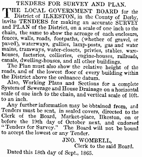
A Local Board sub-committee — the Plan & Survey Committee — was set up to consider the tenders and the one eventually chosen was submitted by civil engineer Charles Sherwood Newman, his total price being £137 6s 8d. He began work almost immediately.
A year later, October 1866, and the map was complete.
Charles did his work in several stages, each one rewarded by an interim payment. There were many difficulties and obstacles along the way but by October 1866 the map was complete and in November the mapmaker was able to display his plan of the district, which measured 12 feet by 28 feet, mounted upon a roller. It was compared with previous maps — William Gauntley’s map of 1795, his enclosure map of 1798, and another of his maps dated 1817, but as they were all at least 50 years before, this was a meaningless exercise.
Charles’s map was the so-called (at least by me !!) ‘Local Board Map‘. He was paid his final instalment on January 1st 1867.
The map was initially kept in a specially-made box and was taken out from time to time, for examination. This had led to wear and tear, and minor damage. Thus, in November 1872 the Board decided to investigate a means of hanging it from the walls of the Board-room.
——————————————————————————————————————————————————-
The Market Place area, adapted from the map of Charles Sherwood Newman, made in 1866 for the Local Board.
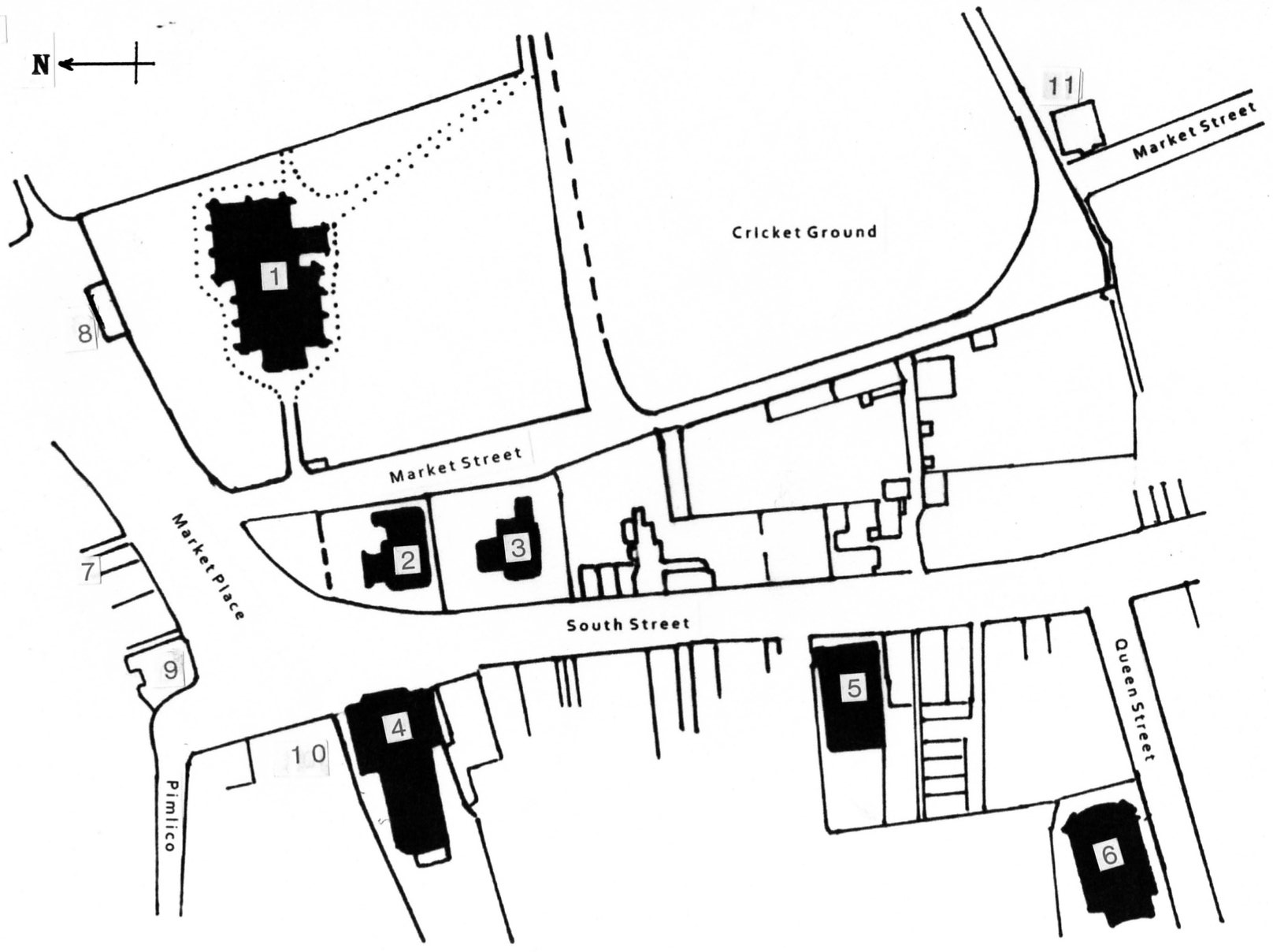
1. St. Mary’s Church.
2. The National School for Boys, opened in 1861.
3. The National School for Girls, opened in 1851.
4. The Town Hall.
5. The United Methodist Free Church Sunday School rooms, opened in 1865.
6. Queen Street Baptist Chapel, opened in 1858.
7. Market Inn.
8. The Butter Market.
9. The King’s Head Inn.
10. The Sir John Warren Inn.
11. The Anchor Inn.

A section of Charles Sherwood Newman’s Local Board Map 1866, showing the same Market Place area
——————————————————————————————————————————————————-
So, let’s now move on to begin our exploration of Education in Victorian Ilkeston … starting with the Butter Market ….. where else ??!!
