We are now going to take a walk along the east side of Town Street alias South Street from the Toll Bar at White Lion Square up to the Market Place. Along the way we will meet the residents and tradespeople who make an appearence in the next section’s of Adeline’s tour.
The first map is an extract from William Gauntley’s Enclosure Award Map of 1798, showing South Street at that time – the street was then called Town Street. The numbers on the map refer to the owners and/or occupiers of each plot of land. You will see how sparsely populated was this part of Town Street with many gardens and much open land behind the relatively few buildings. You might also notice that several of the lateral streets which now connect to South Street — like Queen Street, Gladstone Street and Coronation Street — haven’t been laid out yet.
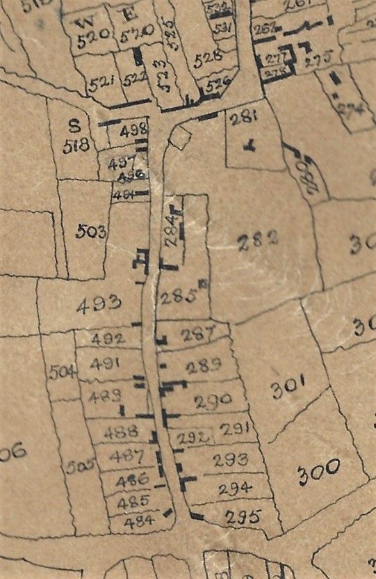
Town Street (later South Street) in 1798
We start at Plots 295 and 294 which contained two houses within a croft and were owned by the Skevington family. However shortly after this map was drawn up the plots came into the possession of John Shaw.
In Plot 293 were premises owned at that time by Henry Skevington but on his death in 1807 they passed to his widow Catherine (nee Matthews). When she died in 1809 they were inherited by his son William.
Plot 292 housed the Baptist Chapel Meeting House, built in 1784 on land which had been owned by Joseph Simpson.
Plot 291 contained a house and croft, both still owned by the same Simpson family, as well as a house, workshop and garden belonging to saddler Ralph Shaw. This area was later to be known as Robey Yard, named after the family who had moved into Ilkeston about 1850.
Plot 290, containing a house, shop and croft, was owned by butcher John Beardsley; he was also Churchwarden at St. Mary’s. When he died in 1808 the property passed to his grandson John Brentnall, son of William and Sarah (nee Beardsley).
Plot 287 was a house and croft owned by yeoman John Hawley and when he died in 1794 it passed to his widow Phoebe (nee Potter), although it was tenanted by joiner Samuel Birch and his family.
Plot 286 which appears not to be numbered on the map, is within Plot 285; it is in fact the small black square which signifies the Old Cricket Ground Chapel.
Plot 285 is the homestead and blacksmith’s premises of James Burgin-Richardson. He had inherited this from his older brother John when the latter died in 1796.
Plot 284 contained about six houses as well as a workshop and garden. They were all in the possession of wheelwright Francis Burgin-Richardson, the brother of James and John (just mentioned). When he died in 1800 they passed to his eldest child Robert Burgin-Richardson; he had recently married Elizabeth Beardsley, the elder daughter of butcher John (see Plot 290). The house were let out to various tenants one of which was John Stockley who gave his name to the yard in this plot.
Plot 282, surrounding the parish church was owned by the Duke of Rutland.
———————————————————————————————————————————–
South Street in 1866 (south end)
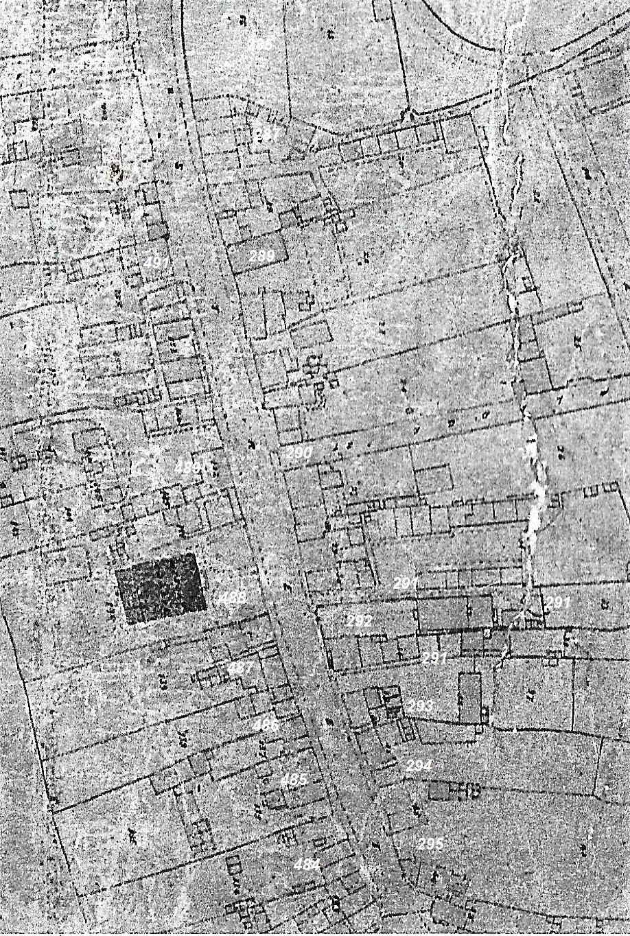
By 1866 295 and 294 had various tenants. One man who had a shop in this area was saddler Ralph Shaw.
293 was the area now known as Robey (Robey’s) yard, after the family who lived there.
292 was still the plot housing the original Baptist Chapel of Ilkeston. However a new chapel had been built in Queen Street in 1858 and since then the old chapel had been used as a children’s Sunday School.
291 housed a group of cottages in what was called Baptist Chapel Yard, later known as Truman’s Court although other parts were owned by Ralph Shaw. The beerhouse on the north corner of the Court was the Prince of Wales.
In 290 the new street known as Pledge Street had just been developed, leading eastwards into Market Street; it was shortly after this renamed as Gladstone Street. From here to Plot 287 were the shops of several tradesmen.
At 287 was Weaver Row which also into Market Street, and between the two were the shops of several prominent tradesmen.
At 287 was Weaver Row which led into Market Street.
285 was home to the Warner family and its timber trade, with timber yard and saw mills. Burgin Yard, later the route for Coronation Street, was also there.
Within that plot was 286 which housed the Old Cricket Ground Chapel, now used as a Wesleyan Sunday school.
284 was the site of Burgin’s Row and Stockley Yard.
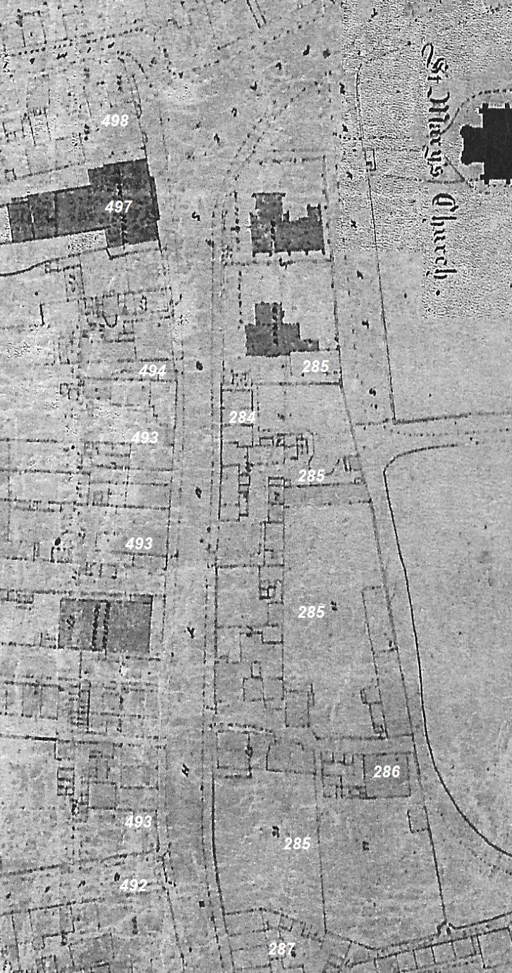
Finally, in what is today regarded as the upper Market Place, we find two National Schools (under the ‘patronage’of the Vicar of St. Mary’s church).
For more information on this area see here.
South Street in 1866 (north end)
———————————————————————————————————————————————
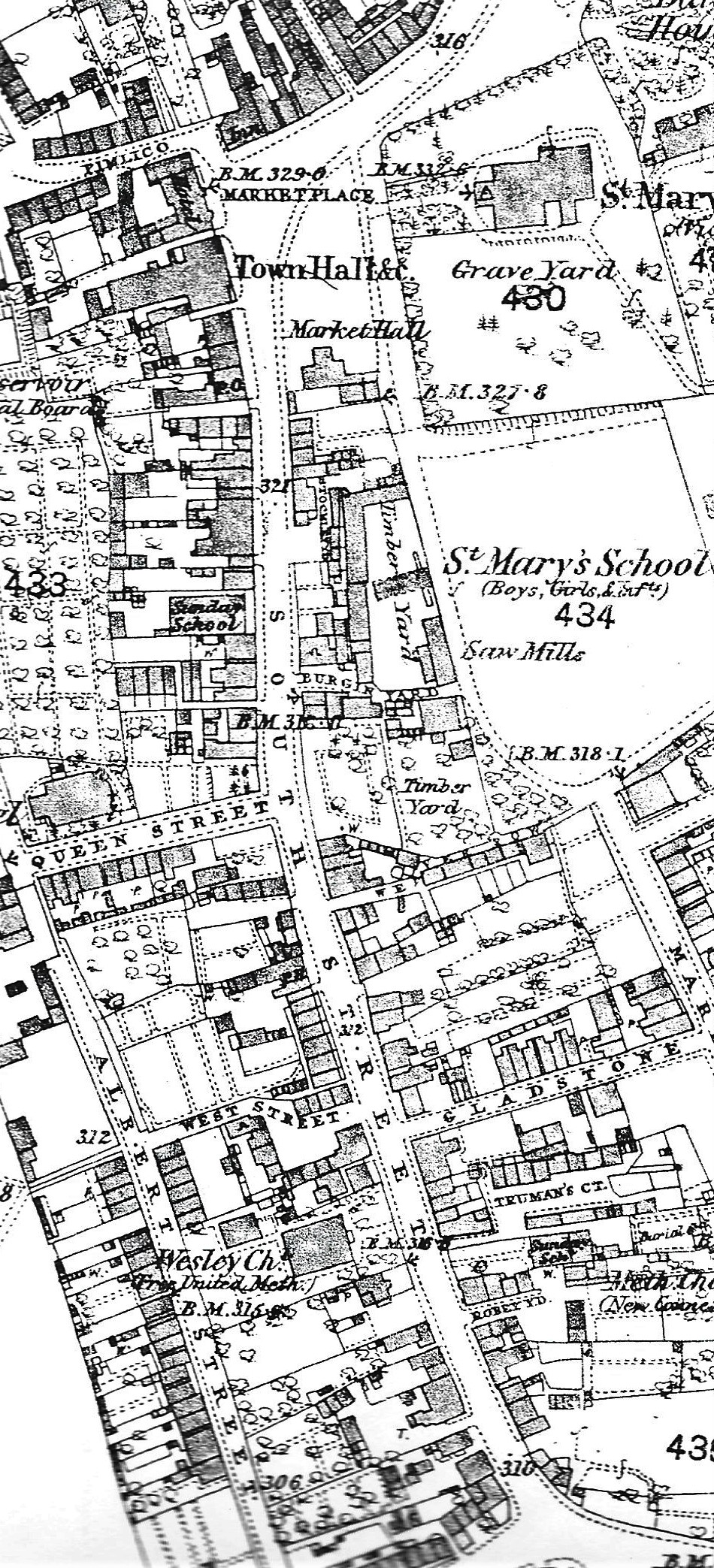
South Street in 1881
And this is an extract from the O.S. map of 1879-1881 showing the same area of South Street.
You will see many of the buildings already mentioned are still there.
But one difference is that one of the two schools built in the upper Market Place has been demolished; the other one has now been converted into the Market Hall.
A new school called St. Mary’s School has been built to replace them and is on the map.
You will notice the development of Albert Street and many other premises appearing behind the main thoroughfare.
———————————————————————————————————————————————
** the extract from William Gauntley’s Map of 1798 is courtesy of Jim Beardsley’s Collection.
———————————————————————————————————————————————
So let’s now start at the Toll Bar, at what is now the Health Centre on South Street.
