We are now going to take a walk down the west side of South Street from Pimlico to White Lion Square, taking a few detours in our walk. Along the way we will meet the residents and tradespeople who make an appearence in the next section’s of Adeline’s tour.
The first map is an extract from William Gauntley’s Enclosure Award Map of 1798, showing South Street at that time – the street was then called Town Street. The numbers on the map refer to the owners and/or occupiers of each plot of land.
To help you get your bearings, St. Mary’s Church is the building in Plot 281 and Town Street (South Street) stretches from Plots 498 to 484.
You will see how sparsely populated was this part of Town Street with many gardens and much open land behind the relatively few buildings. You might also notice that several of the lateral streets which now connect to South Street — like Queen Street, Gladstone Street and Coronation Street — haven’t been laid out yet.
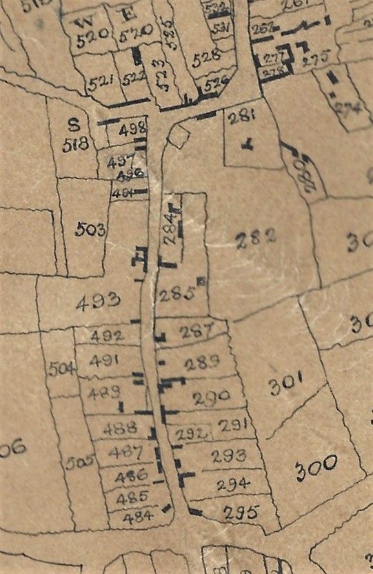
Town Street (South Street) in 1798
So, starting at the north end, we see plot 498 – this is the area owned by Isaac Attenborough and consisted of two houses and a garden. It was at this time that Isaac established the Sir John Warren Inn on this plot of land.
Plot 497 contained several buildings and a garden; it belonged to John Taylor and was later the site of the Town Hall.
Plot 494 with a house, garden and yard was later the site of the Ball family at Ball’s Yard.
Plot 493 was part of the estate of the late William Lowe Read
Plots 492 was later to be the site(approximately) Queen Street.
Plot 489 was owned by the Fritchley family – at this time, by Elizabeth (nee Wilson), the widow of John Fritchley of Cossall. It contained several houses and gardens, an area later known as Wide Yard and then renamed as West Street.
Plot 484 contained several premises, a yard and garden. A few years after this map was drawn Ann Saunders/Sanders (nee Raynor) was living there – she was the widow of gardener William.
———————————————————————————————————————————————
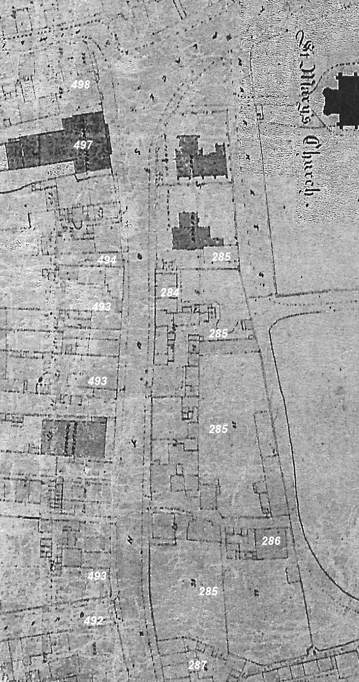
The next two maps are extracts from the Local Board Map of 1866. I have superimposed the Plot numbers from Gauntley’s map to act as points of reference; they do not appear on the original 1866 map.
You will notice how many more buildings appear along the street although there is still a lot of open space, especially away from the main thoroughfare.
The north part of South Street in 1866
At 498 the Sir John Warren Inn has now been built and Isaac Attenborough’s grandson, Isaac junior is now the landlord. The previous landlord, Mark Attenborough, died in 1859 — he was Isaac junior’s father.
At 497 the row of cottages on land owned by John Taylor has disappeared and the Town Hall has just been built.
At 494 we find the entrance to Ball’s Yard.
At 493 we find the Wesleyan Sunday school rooms, opened in 1865.
On both sides of that building have been built several shops and housing.
We also find the entrance to the four houses in Pleasant Place (also known as Carrier’s Buildings, and later as Queen’s Terrace).
At 492 is Queen Street.
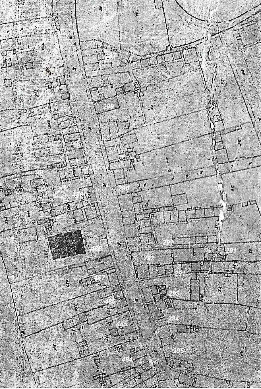
The south part of South Street in 1866
At 492 is Queen Street.
To its south is the old White House, for a time the residence of Francis Sudbury, first mayor of Ilkeston.
At 491 is the Nag’s Head’s beerhouse with several houses to its south. For many years it had an association withh the Knighton family.
At 489 we find the Fritchley estate containing Wide Yard not yet called West Street.
Just below it (to the south), at Plot 488 we can see the South Street Wesleyan Chapel, opened in 1845.
Between the chapel and Derby Road there are several shops with dwellings including that of Joseph Shaw, the butcher, and William Saunders, the gardener.
———————————————————————————————————————————————
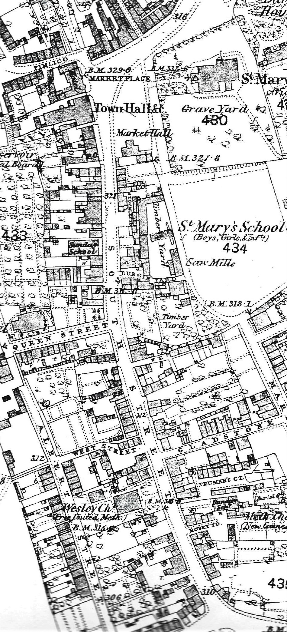
South Street in 1881
And this is an extract from the O.S. map of 1879-1881 showing the same area of South Street.
You will see many of the buildings already mentioned are still there.
But one difference is that one of the two schools built in the upper Market Place has been demolished; the other one has now been converted into the Market Hall.
A new school called St. Mary’s School has been built to replace them and is on the map.
You will notice the development of Albert Street and many other premises appearing behind the main thoroughfare.
** the extract from William Gauntley’s Map of 1798 is courtesy of Jim Beardsley’s Collection.
———————————————————————————————————————————————
Let’s just see how quiet South Street really was
