This section which is a work in progress, is in two parts.
————————————————————————————————————-
Place names in Victorian Ilkeston
Just a selection which will be added to … please feel free to contribute your own suggestions
Albert Villas … a terrace of 14 houses, on the south side of Station Road, between the River Erewash and the Ropewalk
Albion Cottages … a few houses on the east side of Wilton Street
Albion Terrace … a row of half a dozen houses on the south side of Northgate Street (Bath Street end)
Babbington’s Cottage … down Station Road, with a frontage to the north side of that road and to the Erewash Canal. It adjoined the Day Gore Close, an area of land used as a coal wharf up to the late nineteenth century when it was acquired as building land.
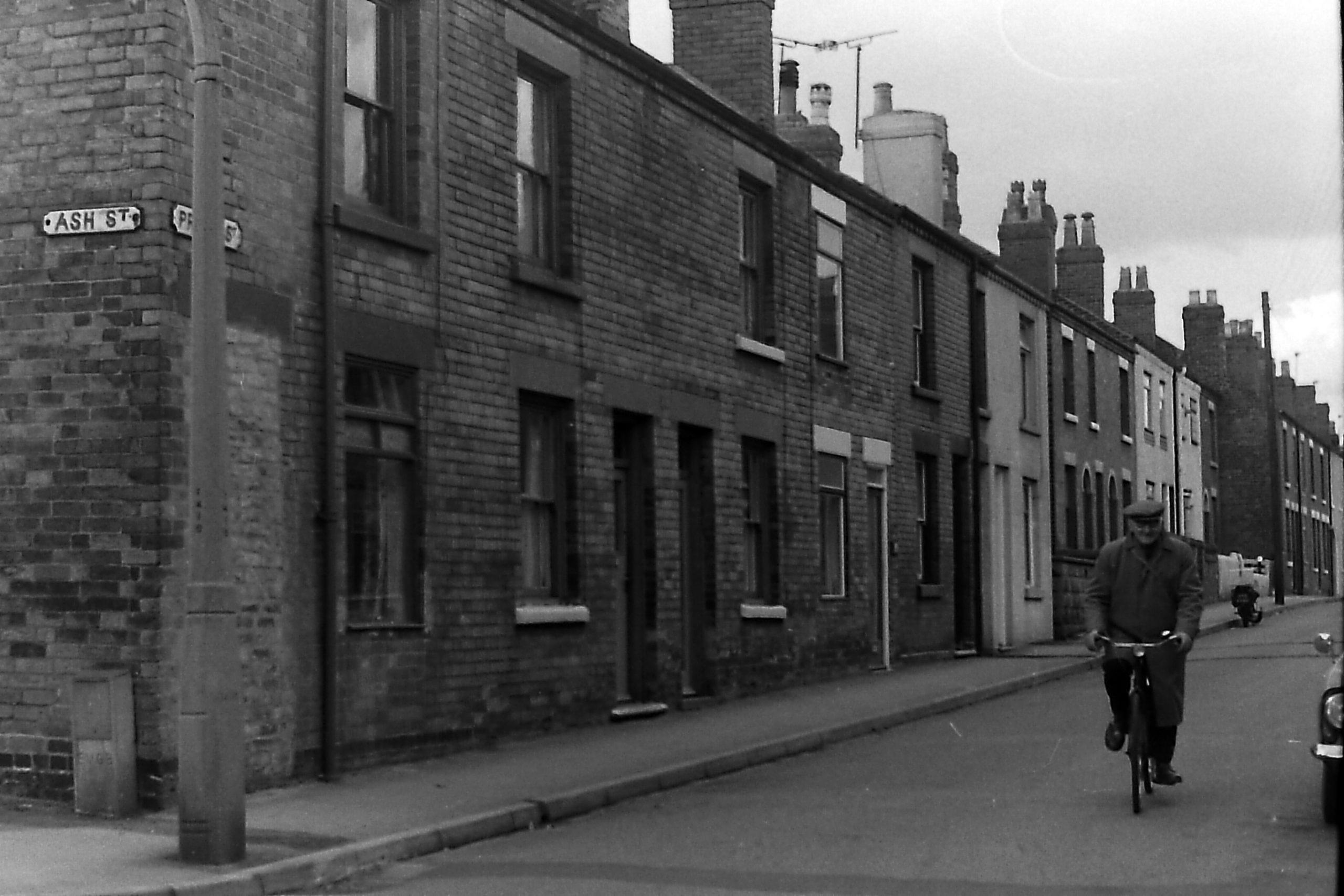
Beer’s Lane or Bear’s Lane … probably named after its occupants. Later known as Ash Street.
Belvoir Street … connects Granby Street and Lower Bloomsgrove Road. Walking from the Granby Street end you would pass William Street, then Tutin Street, and finally Cambridge Cottages
Blacksmith’s Yard … off the east side of Awsworth Road, just to the north of Spring Garden Terrace
Boot Lane … a former name for Stanton Road. Named after a properous family which lived there
Bottom Road … the eastern part of what is now Awsworth Road, as it approaches the Erewash Canal
Brewery Row … off Bottom Road, later Awsworth Road. A group of houses by the Erewash Canal and the Jolly Boatman Inn
Cambridge Cottages … a group of six houses off the north side of Belvoir Street
Carrier’s Buildings … see Pleasant Place
Clarence Street … for a very short time, the former name of Rupert Street
Commercial Terrace … a row of houses off the north side of Awsworth Road, almost directly opposite Springfield Gardens
Common Gardens … off Duke Street
Cordon’s Lane ... a contemporary name of Moor’s Bridge Lane, which was later renamed as Derby Road. Henry Cordon was a lock-keeper on the Nutbrook Canal from 1824 to 1844.
Earl Place … a small yard off the east side of Bath Street, south of the Mundy Arms, just between Talbot Place and Rutland Street
Evans Cottages … housing at the pottery works of Richard Evans. Also referred to as the Pottery. Not connected with Evans Row at Nottingham Road (later White Lion Square).
Evans Shops … workshops and worker’s houses of employees of Richard Evans at the Pottery. Not connected with Evans Row at White Lion Square
Ferns Hollow … premises on the south side of Station Road, between Rupert Street and the Erewash Canal
Fishpond Cottages … premises by the Erewash Canal, at Botany Bay
Fletcher Place … on the west side of Bath Street, directly opposite the Queen’s Head Inn. Where Wilko Store now stands. Named after Samuel Fletcher, lace manufacturer, who later moved into Wood Street.
Foundry Row … close to/same as Granby Court ?
Granby Court … a yard off the east side of Lower Granby Street, at its junction with Granby Street.
Hais or Hays Lane … off the east side of Market Street, close to the site of the old Hallcroft School. Just south of St Mary’s churchyard
(The) Hayes … no 55 Market Street, between Spring Villas and Stratford House; home to Charles John Jackson, solicitor, in the late 1880s
Harefields … home to the Thompson family, late Victorian. In Derby Road, close to present-day Kniveton Park. Hence Derby Road being referred to as HareHills Lane in the eighteenth and early nineteenth centuries.
Hart’s Yard … off Awsworth Road, between Belvoir Street and Bloomsgrove Road, a yard of about four properties
Lee’s Croft … see Wheatley Croft
Marsden Street … originally known as Roberts Street about the end of the 19th century, its name was changed to Marsden Street but after a few years was changed back to Roberts Street
May Street … a new street, proposed in 1893, at the bottom of Station Road but not built
Millfield House … another name for the Park home of the Potter family. At the end of Park Road, once known as Millfield Lane
Milner Street … an earlier name (c 1903) for Westwick Street
Moor’s Bridge Lane … an earlier name for Derby Road
Morris Row … six cottages off the west side of Cotamnahy Road, just south of the Trumpet Inn and north of Hallsworth Row
Mount Row … a group of four cottages to the north of Club Row, and like Club Row, set back from Bath Street. Not to be confused with Mount Street which lay to the south of Club Row.
North Road … later known as Rutland Terrace. This runs parallel and to the east of Lower Granby Street. Not to be confused with North Street
Pigsty Park … a name attached to the houses in the North Street, Carr Street, Critchley Street area of Ilkeston, many of them built by Thomas Shaw
Pleasant Place … a group of four houses off the west side of South Street, built by William Carrier in 1857, and later known as Queen’s Terrace. The jitty still exists but not the houses
Pledge Street … off the east side of South Street. Laid out in the early 1860s when this name was used for a very brief period. Renamed Gladstone Street in the later 1860s, perhaps as a result of Liberal politician William Gladstone becoming Prime Minister for the first time, in 1868. Ilkeston’s Local Board was dominated by Liberals.
Queen’s Terrace … see Pleasant Place
Revill’s Yard … at the top of Bath Street, on its west side. Also known as Bath Street Terrace, and previously as White’s Yard.
Severn’s Yard … another name for part of High Street, leading to what is now Erewash Museum
Sisson’s Yard (1) … on the west side of Heanor Road linking that road with Back Lane; opposite Bailey’s Factory
Sisson’s Yard (2) … found at the north end of Eyre’s Gardens
Skevington’s Yard … later known as Robey’s Yard. A group of about 3 sometimes 4 households, off the east side of South Street, situated to the south side of the old Baptist Church
Spring Villas … a small terrace on the west side of Market Street close to its junction with Gladstone Street
Station Cottages … a group of three houses in Brussels Terrace, later numbered 30-32
Talbot Place … a small yard off the east side of Bath Street, between the Mundy Arms and Earl Place
Tutin Street … off the north side of Belvoir Street
Wheatley Croft … also known as Lee’s Croft, a group of houses, appearing on the 1841 census, lying between Lee’s Yard and Burr Lane. At the east end of what was later Albion Place.
Wheatley Row … a group of 13 houses off the north side of Pimlico; they stood on the east side of what is now the Croft Yard Reservoir and were part of the estate of builder/mason John Wilson Wheatley (1836-1896)
West View … four-bedroomed house at 18 Granby Street (south side, on the corner with Lower Granby Street). Once home to the Weatherhog family.
White Lion Square … that part of Nottingham Road from the White Lion Inn to South Street, renamed by the Council as White Lion Square in 1889
Wide Yard … a cul-de-sac yard off the west side of South Street. Later renamed West Street when it was extended into Albert Street
William Street … off the north side of Belvoir Street
York Street … a new street, proposed in 1893, at the bottom of Station Road but not built
————————————————————————————————————-
Photograph Album
Fifty years ago, Jim Beardsley composed a photographic record of Ilkeston streets and premises, many of which had Victorian roots. Here is just a selection of his photos (in alphabetical order)
If you wish to add your own contributions, please send them in to me … [email protected]
Albert Street
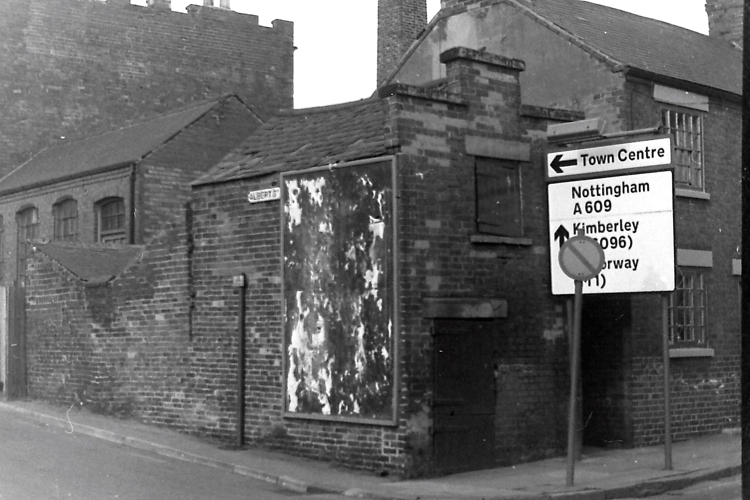
Named after Prince Albert, husband of Queen Victoria, part of this street, where it joins to Queen Street, dates from the late 1860s. Albert had died in 1861.
“There used to be a nice foot road from Queen Street to Derby Road. The Local Board has allowed this to be illegally stopped, and they profess to have surveyed and set out a new street, called Albert Street which is quite useless and impassable”. (a letter in the Ilkeston Pioneer 1871)
The street was eventually extended in both directions, up to Wharncliffe Road and down to Nottingham Road. This photo shows the junction of Albert Street and Nottingham Road, with the last house in Chain Row on the extreme right.
Albion Place
In the past this area had several different names — the Gangway, Lee’s Yard, Glazier Lee’s Yard, Jackie Lee’s Yard — named after the plumber and galzier John Lee who had acquired the land in 1804.
Barker Gate
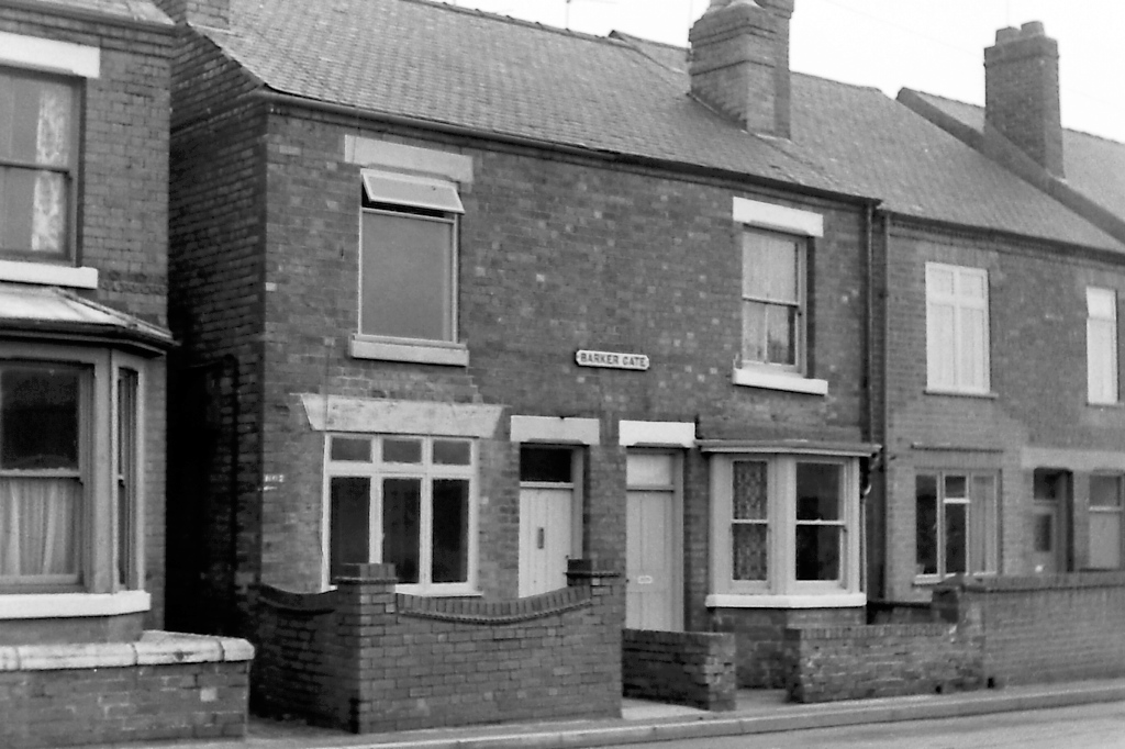
Barker Gate formed a continuation of Bloomsgrove Road and where the two joined stood Number 1 Barker Gate. The road then continued to join Belfield Street at a T-junction, close to Trinity Street (below). Number 1 is purported to be at the left of this photo and was the home of John Ralph Melland Thompson junior at his death in 1929.
Belfield Street
This was a collection of houses developed in the 1880s close to the Gas Works on Rutland Street. Trinity Street was a short cul-de-sac of four cottages off the east side of Belfield Street (and famous for the birth of Johnson triplets there in 1909)
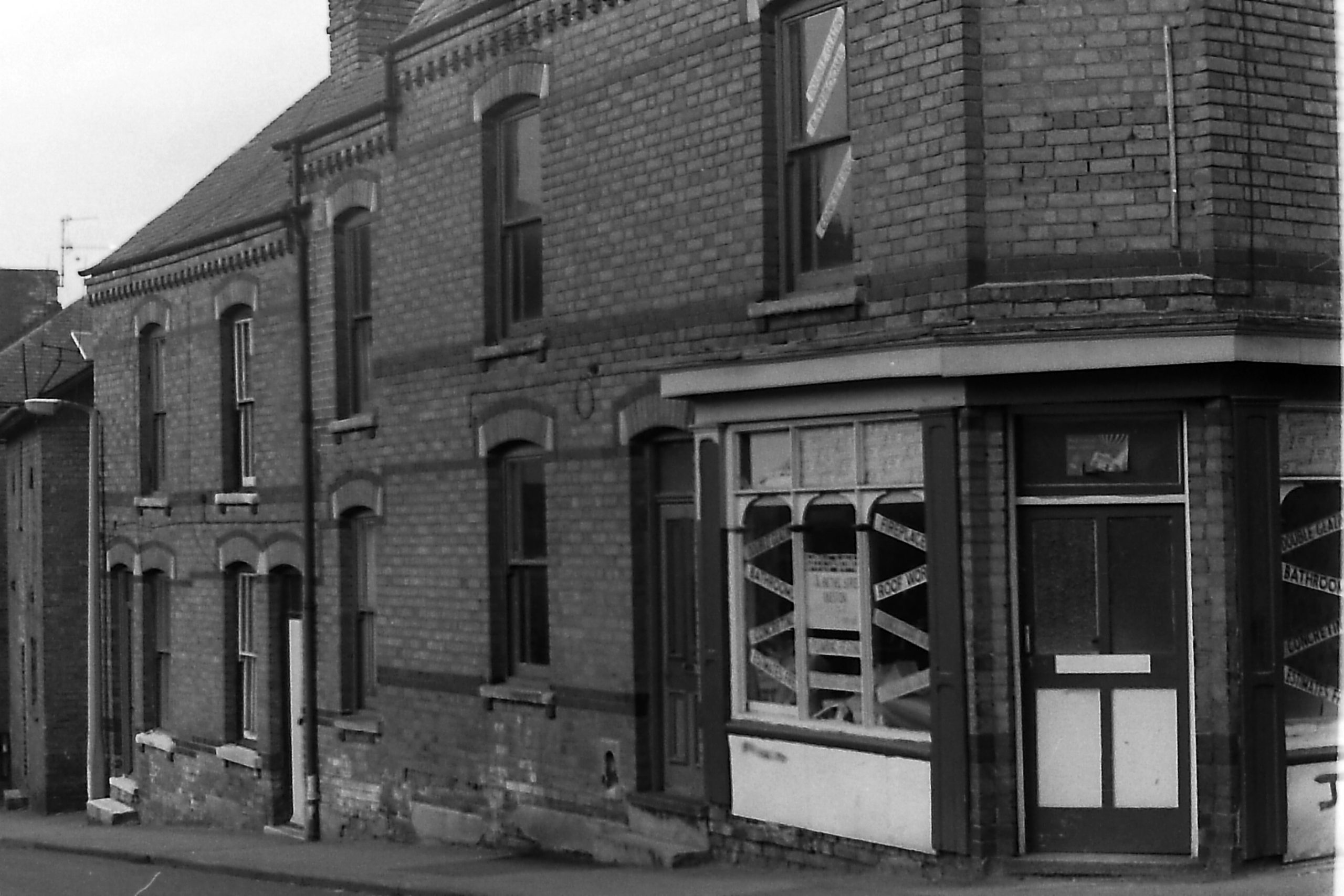
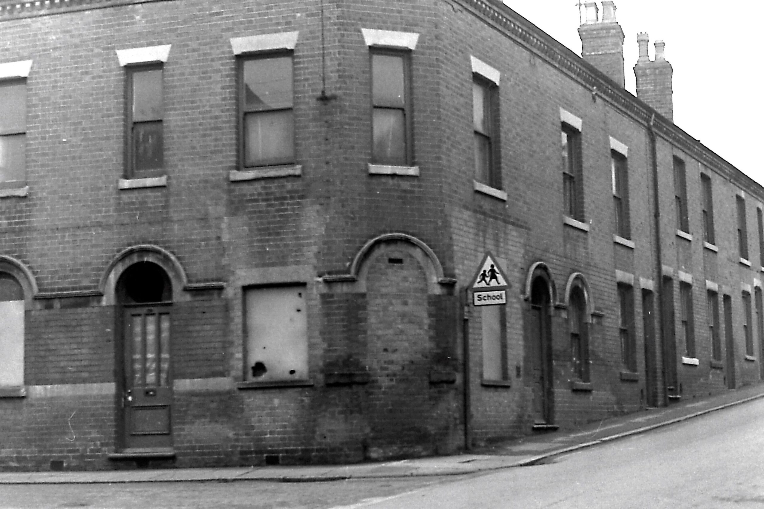
Belper Street
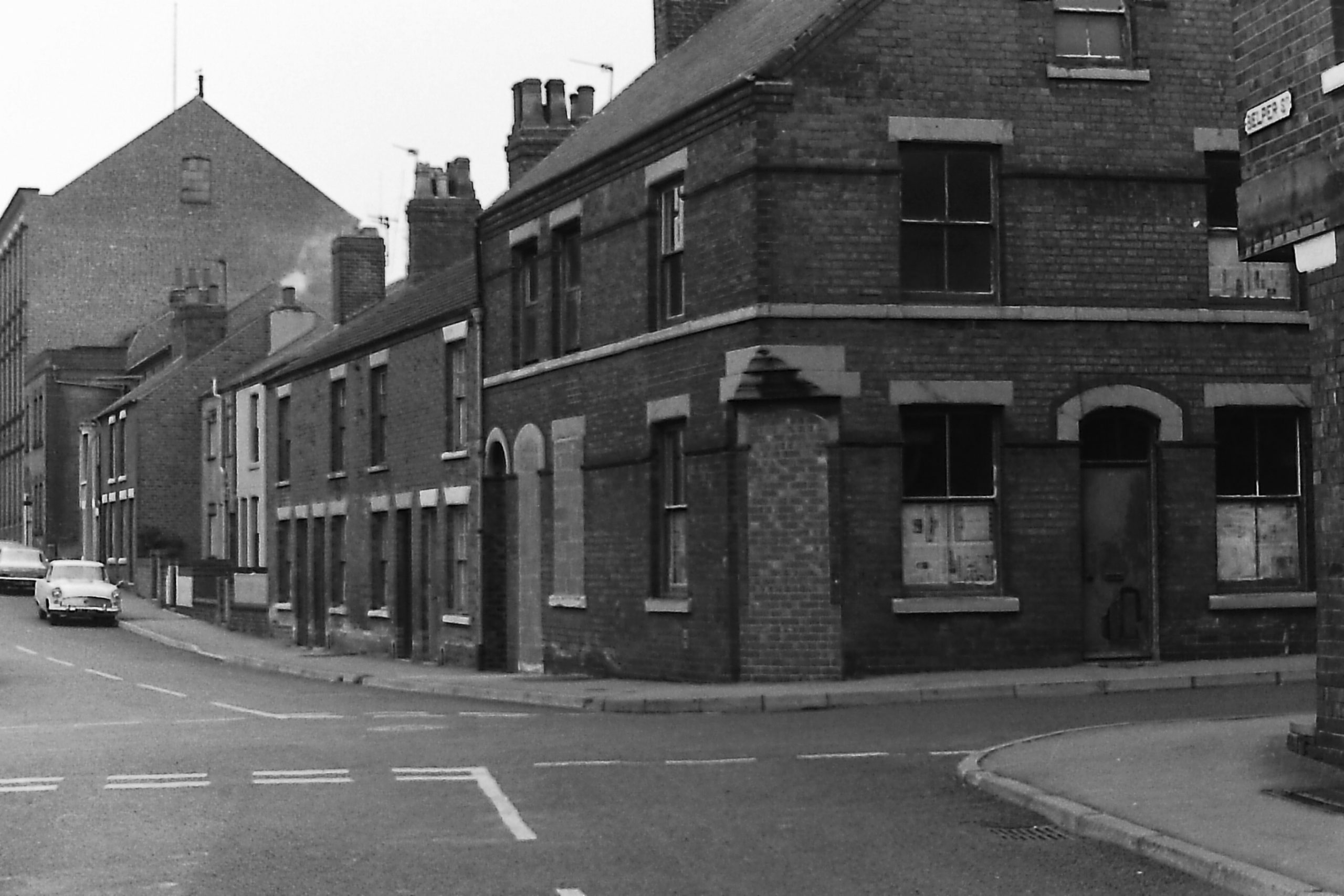
This is the south end of Belper Street where it is crossed by Union Street. Both were declared “public highways” in 1869 by Ilkeston’s Local Board, though Union Street was developed only after 1880. The large building on the left background was originally Amos Tatham’s factory
Bethel Street
Also known as Beniston Place (after the family which occupied premises there) and ‘Little Dustpan’ (after the Beecham family ironmongery in the street), its ‘proper name’, at least from 1892, was Bethel Street after the Bethel Mission which arrived in this short street.
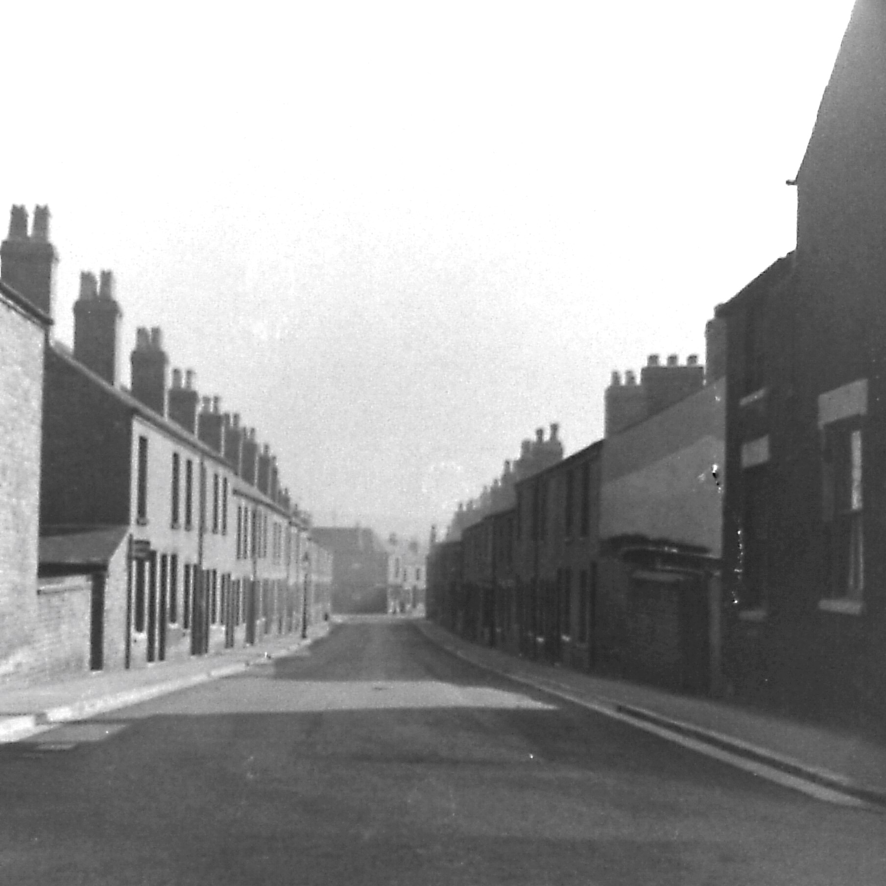
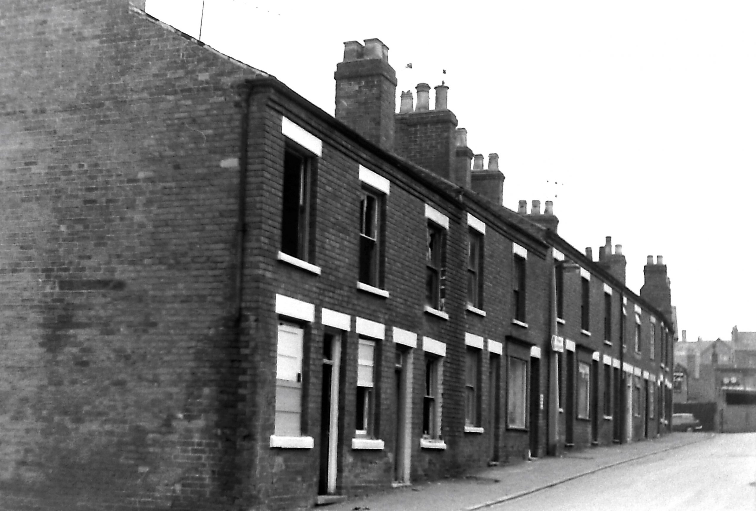
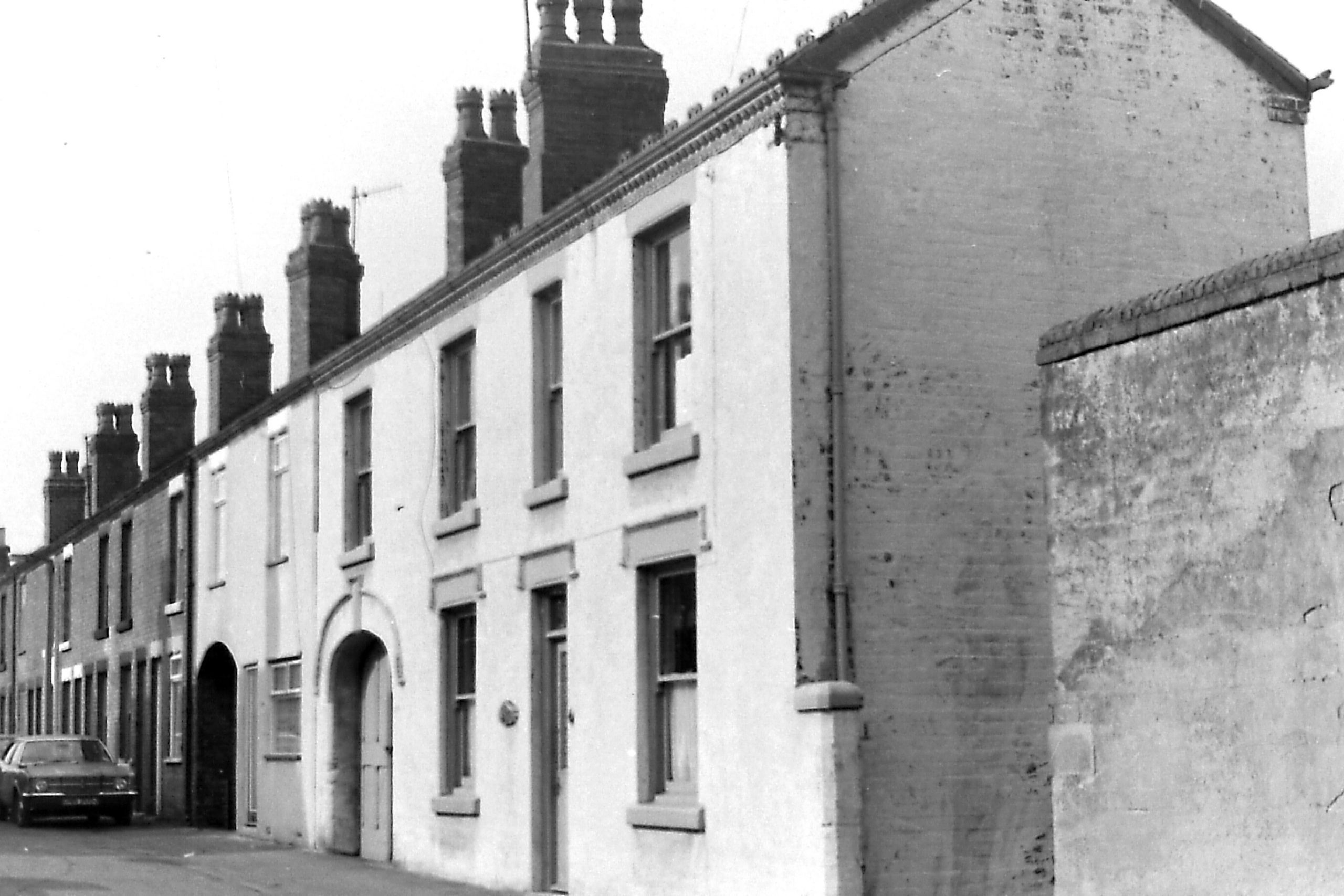
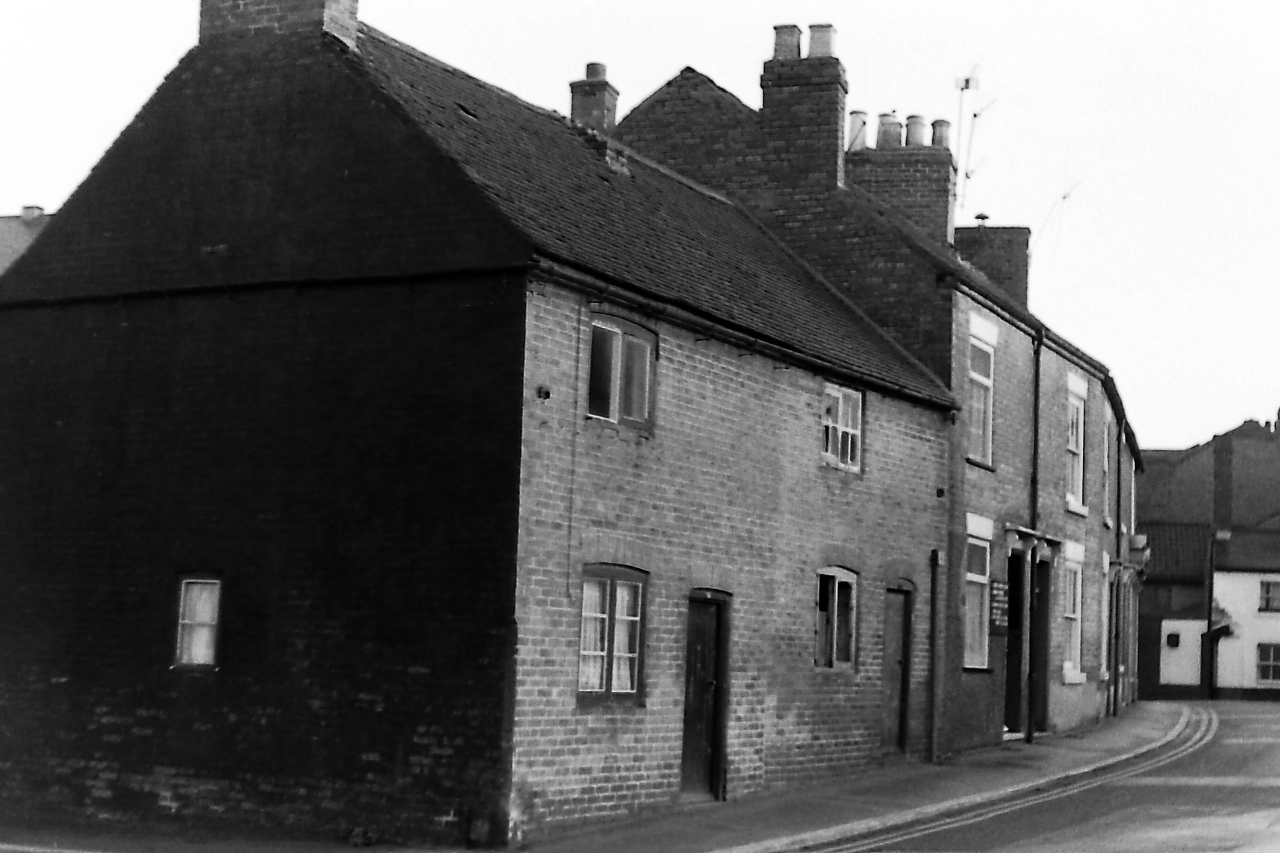
Burr Lane
This photo shows the west side, these houses being developed in the later Victorian period. Towards the right hand side you can see a tall concrete lamp standard, sited where the road crossed Chapel Street, and after that it became the first part North Street. On the extreme right hand side you might just glimpse the Erewash Hotel in Station Road.
Byron Street
Byron Street is on the left and Burr Lane is on the right. This is opposite to the houses shown in the previous photo. The school warning refers to children travelling to and from Chaucer Primary Schools at the bottom of Byron Street.
Carr Street
Nearest the photographer, the first section of this street, on the south side and starting at North Street, was developed in the 1860s. By the 1880s the north side section had been built. However it was only at the end of the 19th century that more houses were built to join it with the newly constructed Wood Street. As the street then crossed Wood Street it became Mill Street.
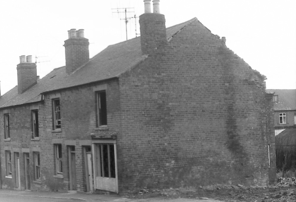
Chain Row
Originally seven houses built in the 1830s, named after the row of linked chains on posts, standing in front of them. Demolished in 1979.
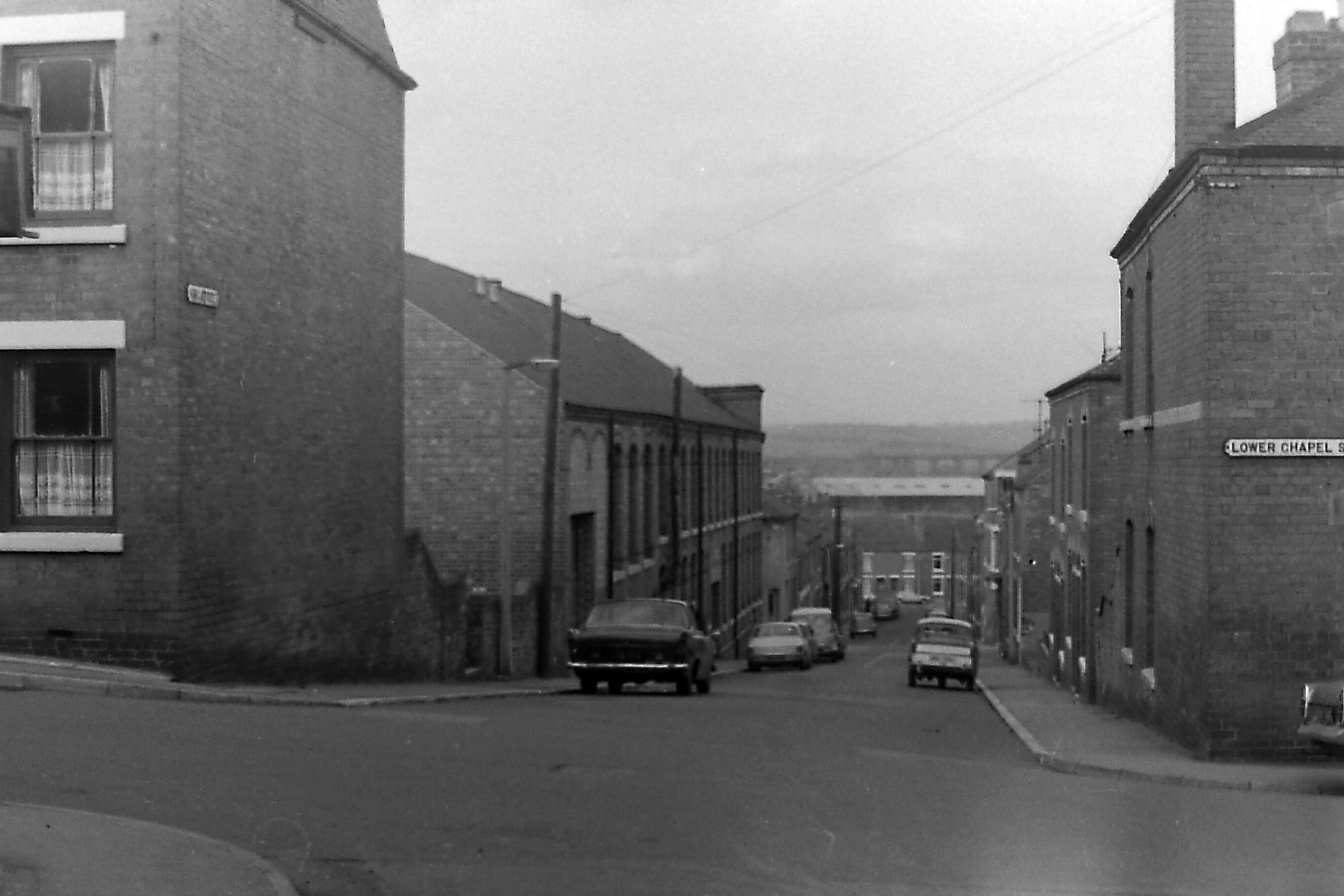
Chapel Street
The chapel in question was the old Primitive Methodist Chapel, built in 1823, which stood on the bare patch of land, right foreground. The photo shows Chapel Street crossing Burr Lane (right) and North Street (left). Chapel Street continues onwards, towards what was often referred to as Lower Chapel Street.
Chaucer Street
This was first developed at the end of the Victorian period, accompanied by the building of the Chaucer Board Schools in the area, from the late 1880s onwards. The street was initially a dead-end and culminated in Shaw’s Brickworks.
Crichley Street
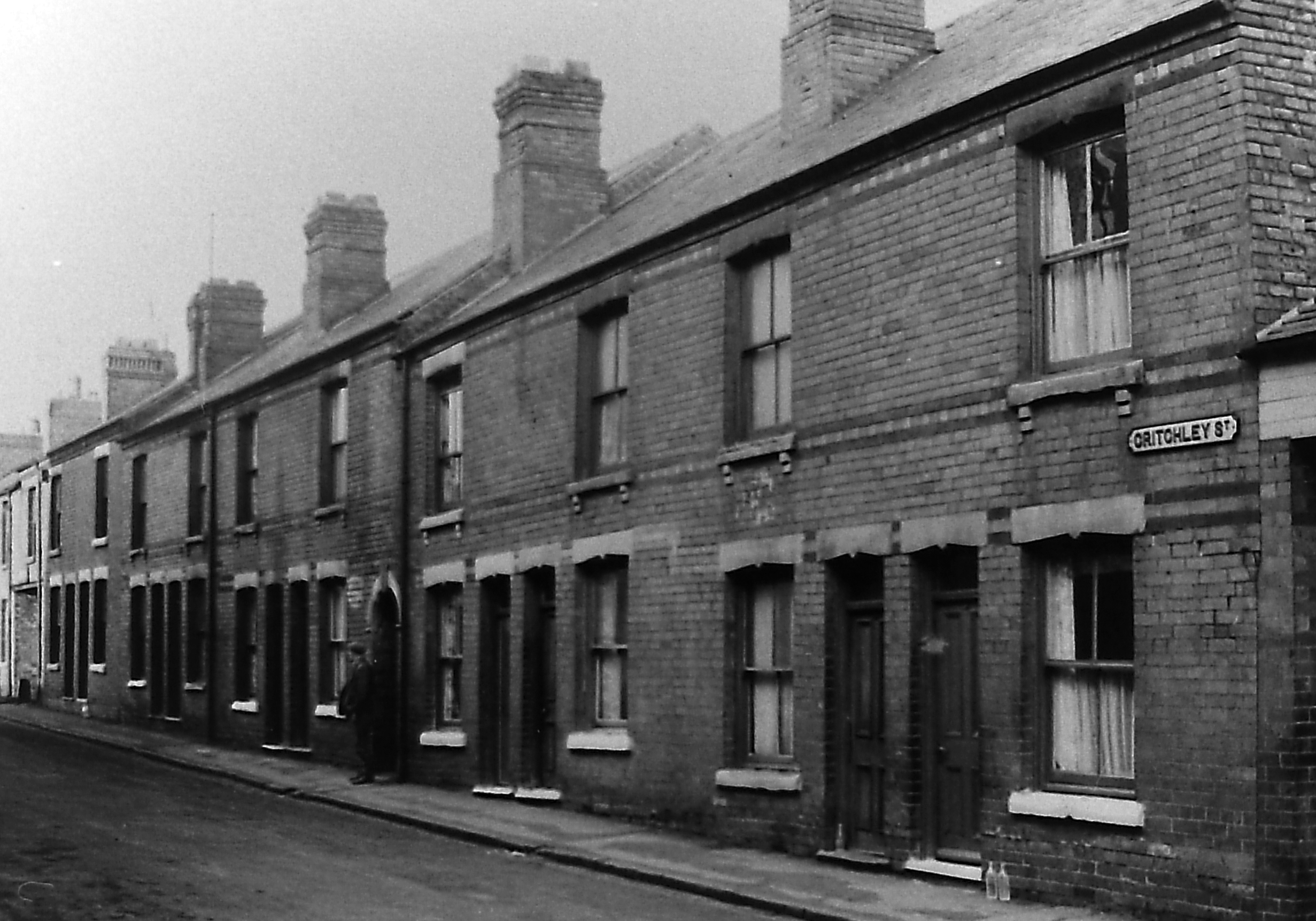
This name derives from the Crichley/Critchley family who owned land at the bottom of Bath Street. The street was part of the so-called (by the Ilkeston Pioneer) “Pigsty Park“, a notorious area of the town, down North Street, and developed by builder Thomas Shaw in the 1860s.
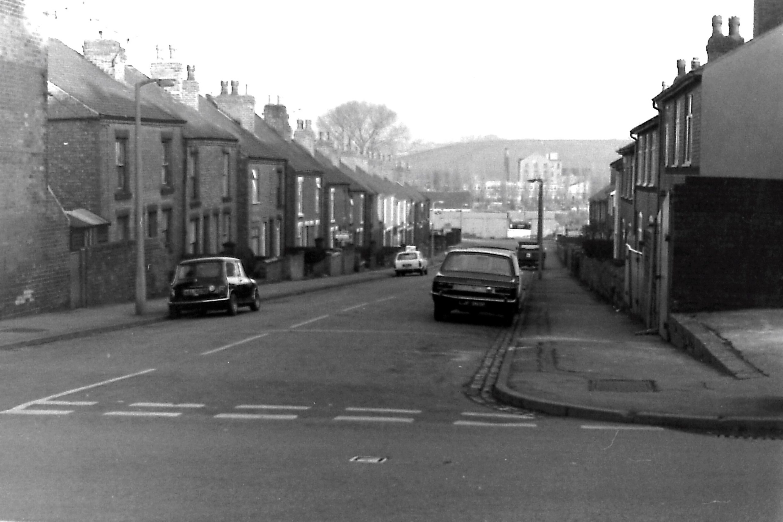
Dale Street
This street seems to have been born out of the development of the new cemetery — Park Cemetery — now at the end of Park Avenue, when access to the new burial ground needed to be improved. This was in the early 1890s. Percy Street can be seen off the right foreground.
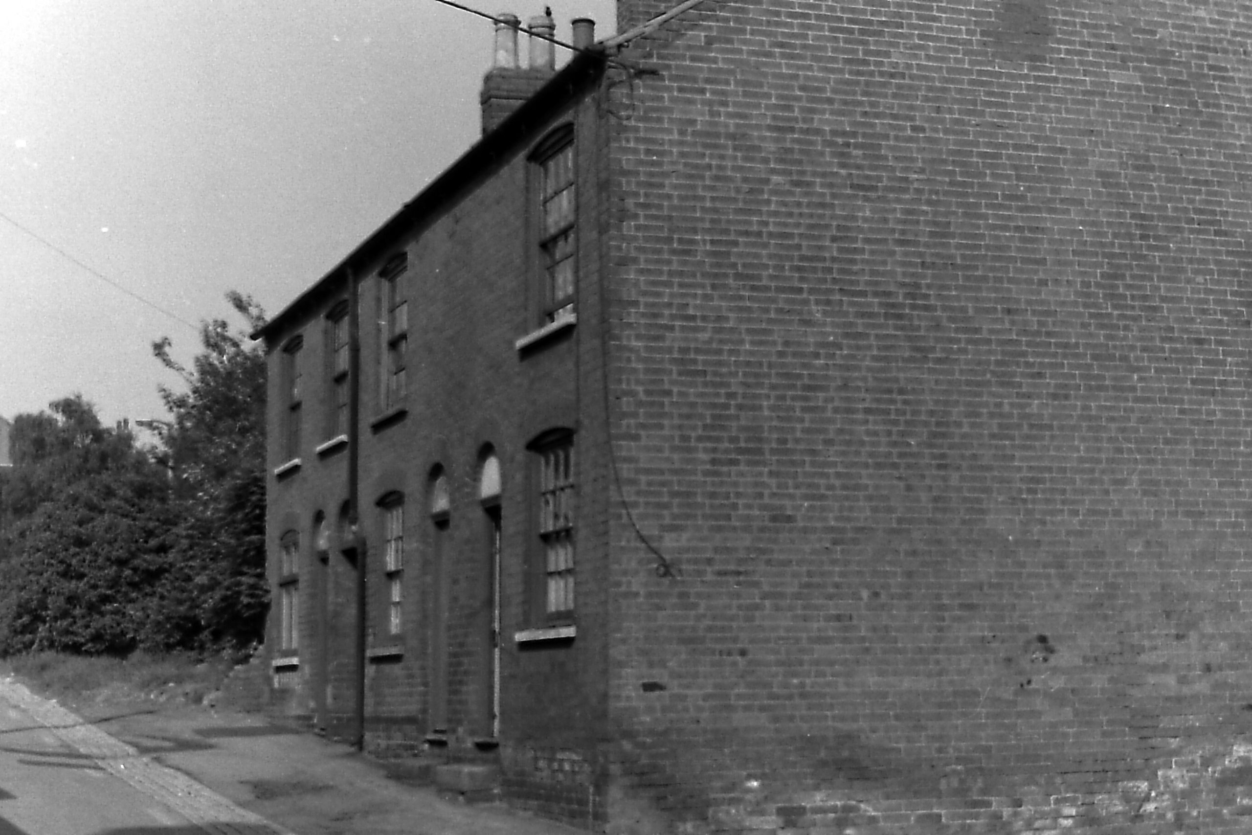
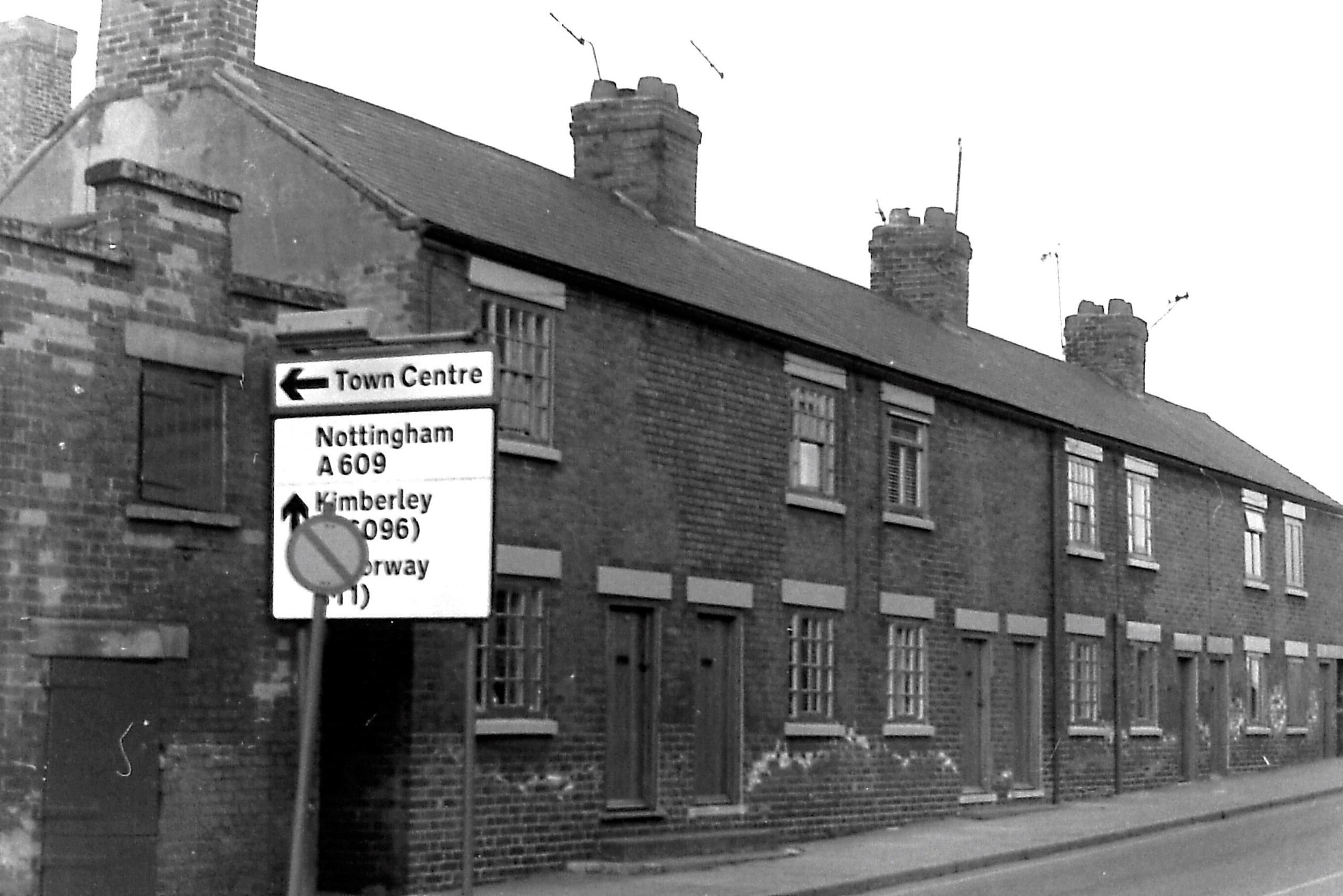
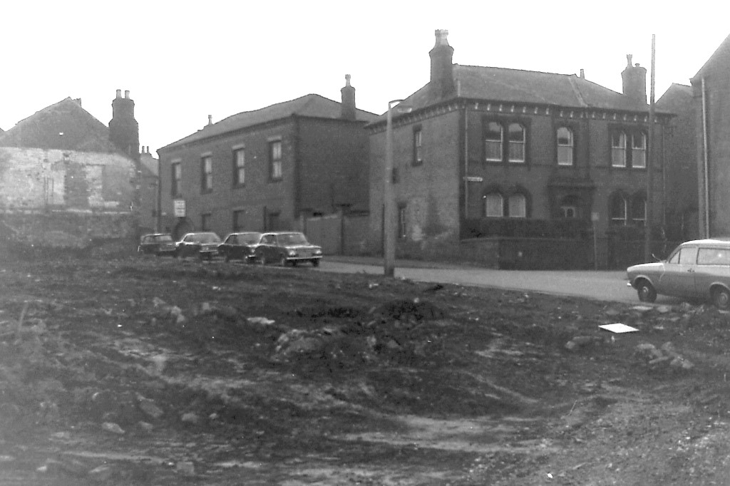
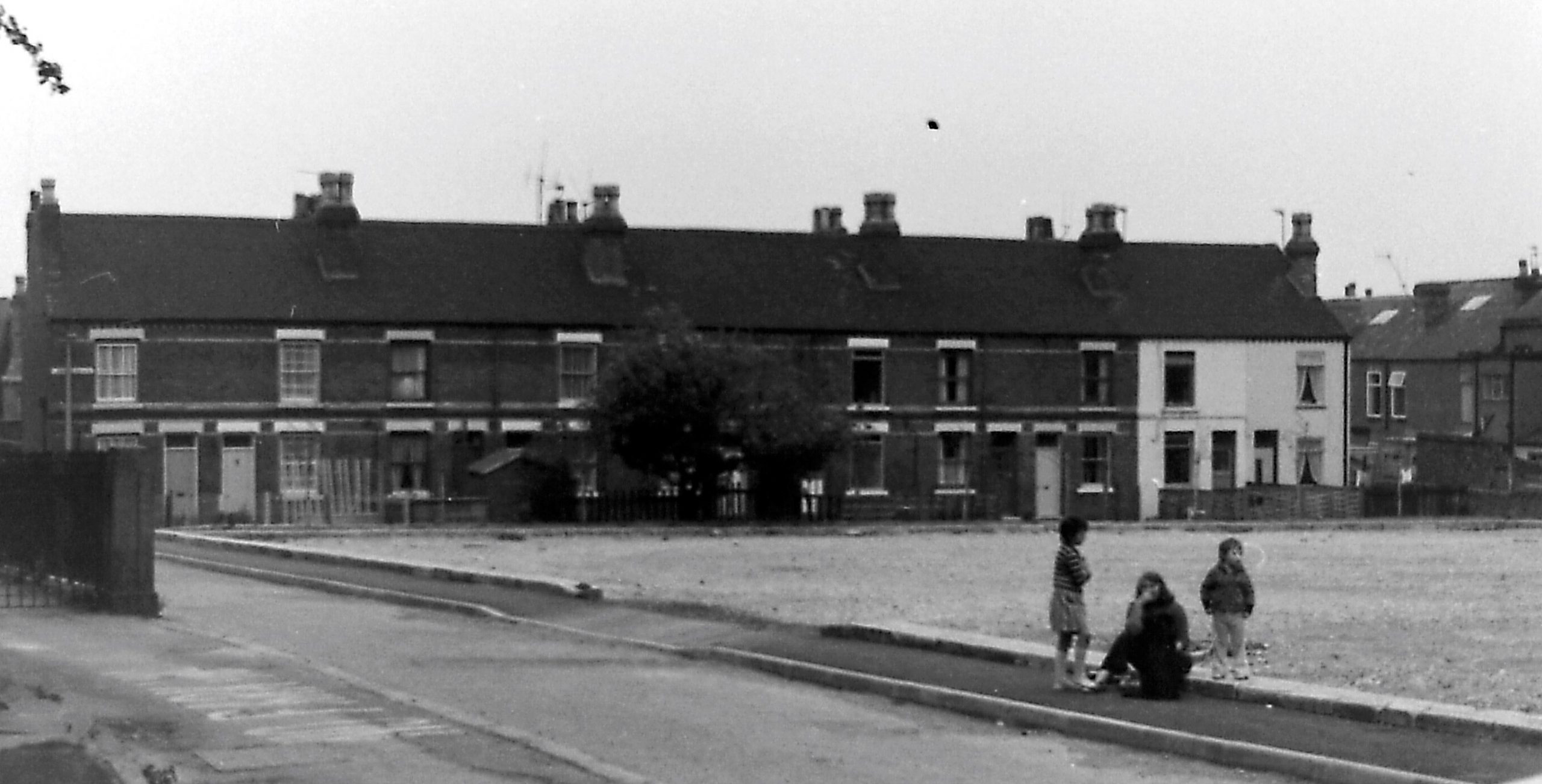
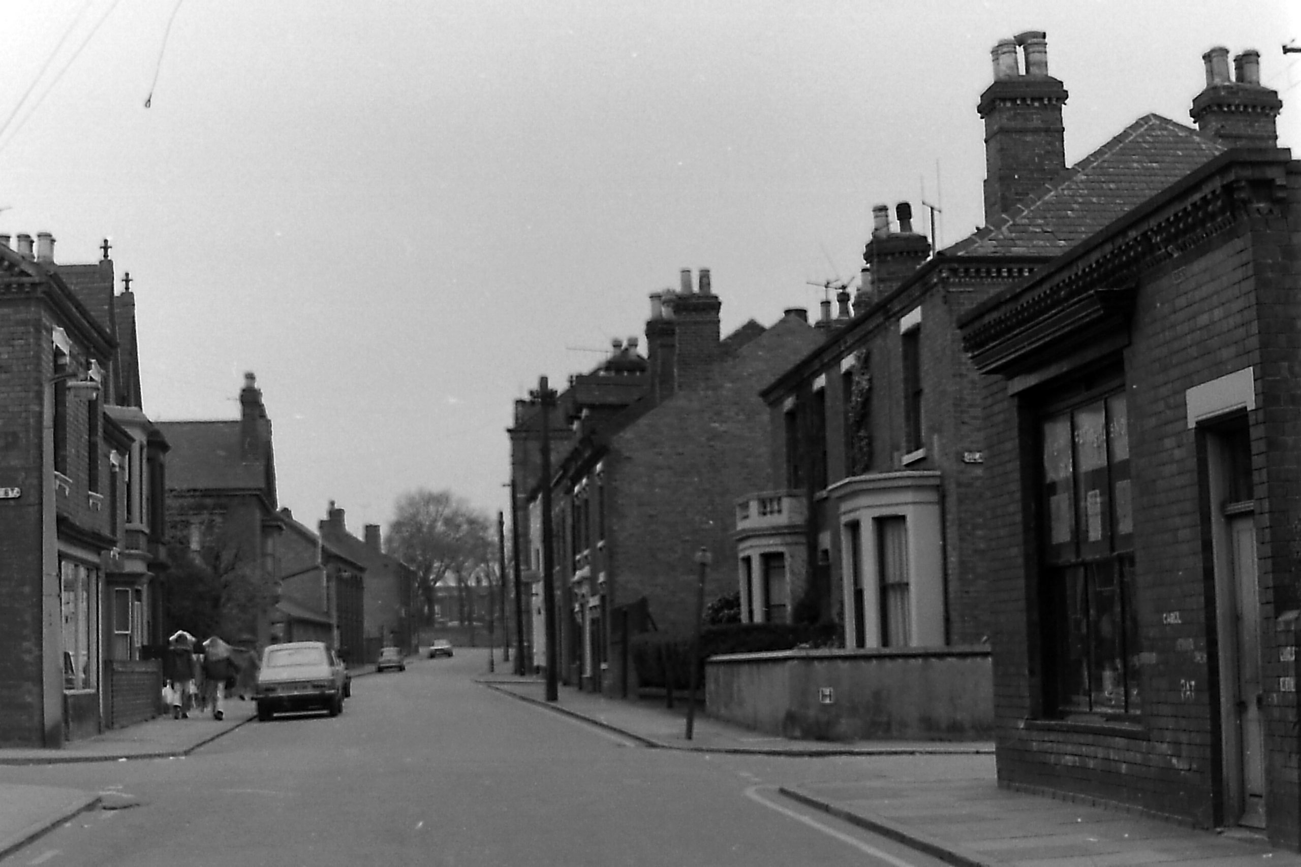
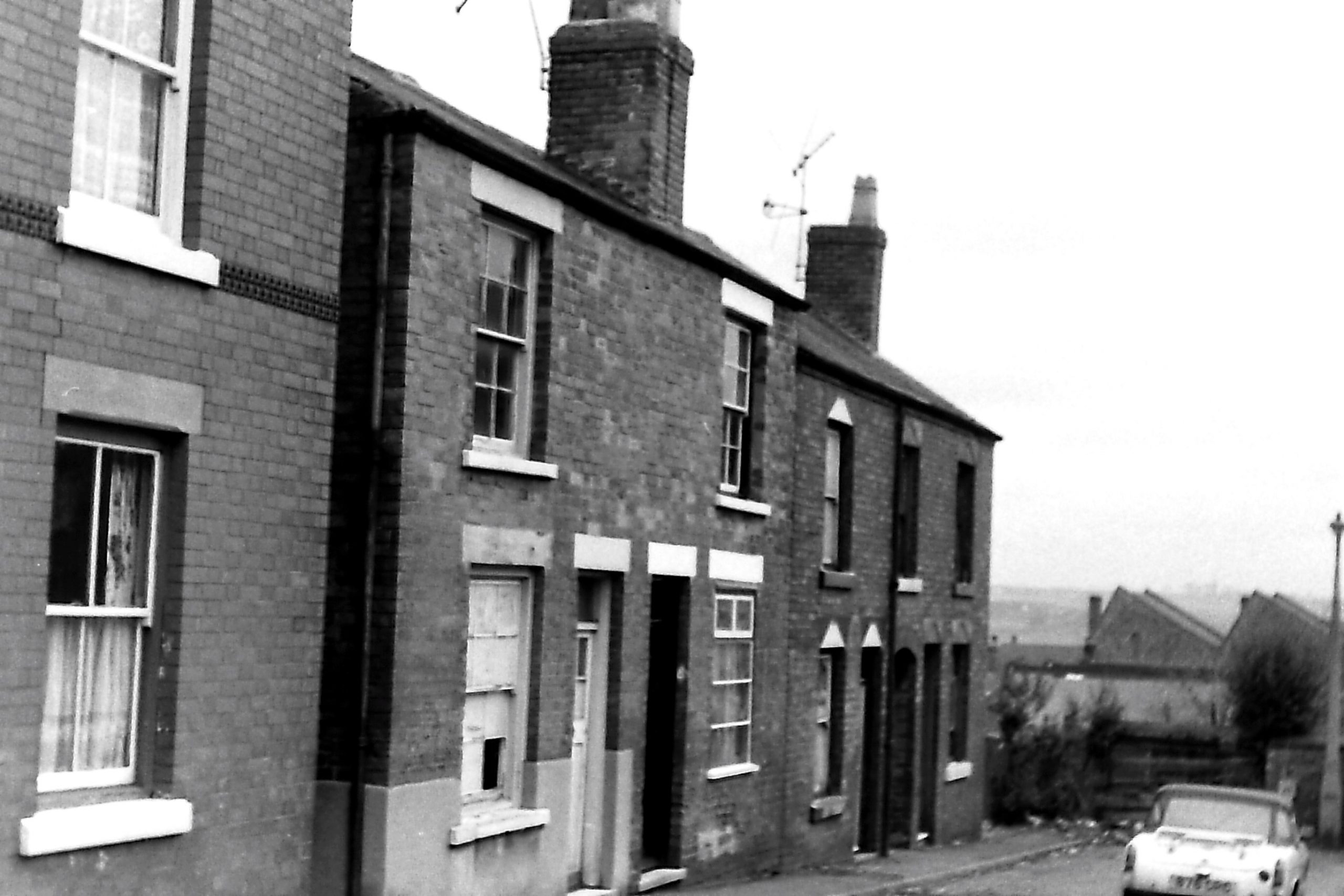
Derby Road
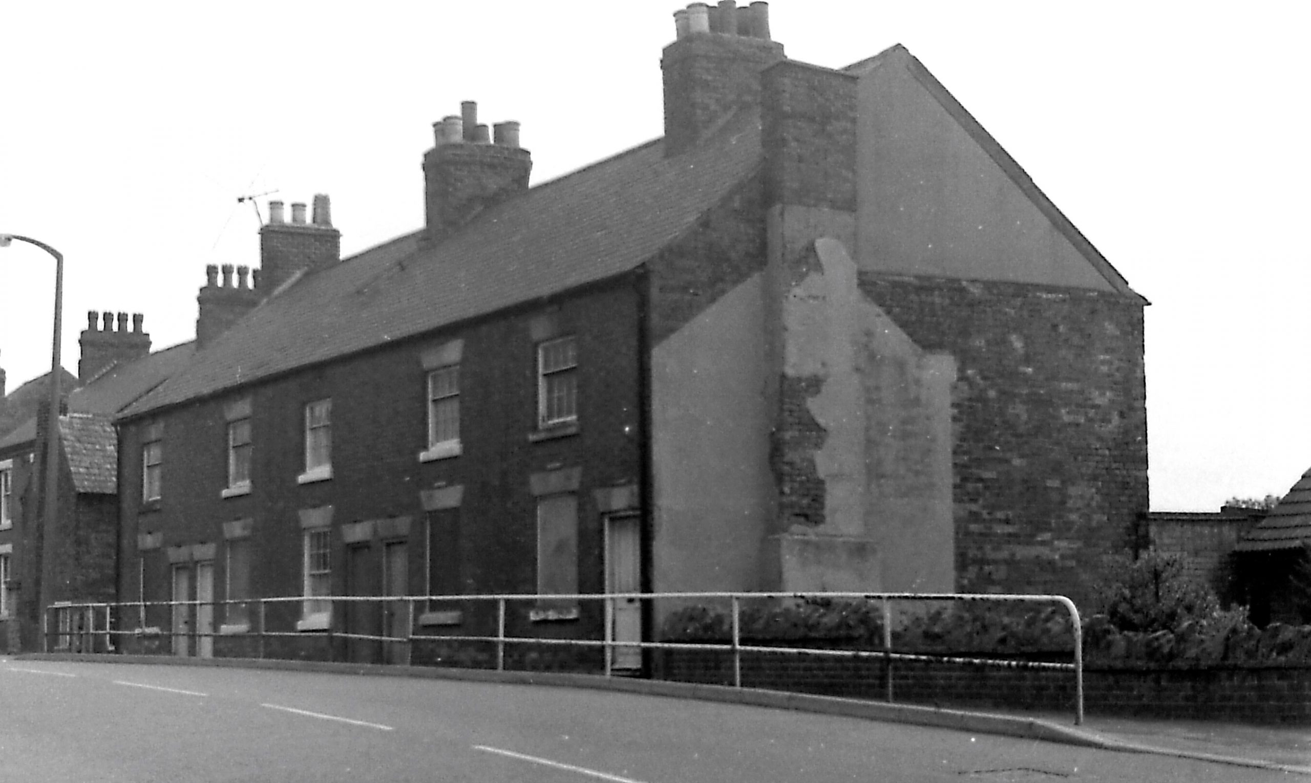
This road has had a variety of names in the past, the most frequently occurring one being Moore’s Bridge or Moorbridge Lane. The photo shows a group of houses on the west side.
Durham Street east
Its previous name was Belvoir Terrace. This is how it appears on the 1871 census, with John Trueman occupying the Durham Ox Inn at number 7. He was also at the Inn “in Belvoir Terrace” in 1861. And in 1881 Belvoir Terrace continued to exist though still with houses on its east side only, by which time John’s Durham Ox Inn had mysteriously ‘shifted’ to Northgate Street !!
By 1891 Belvoir Terrace had changed its name to Durham Street with the Durham Ox now at number 23. (Although Belvoir Terrace had disappeared, a Belvoir Street had now appeared in Ilkeston).
This photo shows the houses on the east side with the Inn at the far end. The car is parked in Northgate Street.
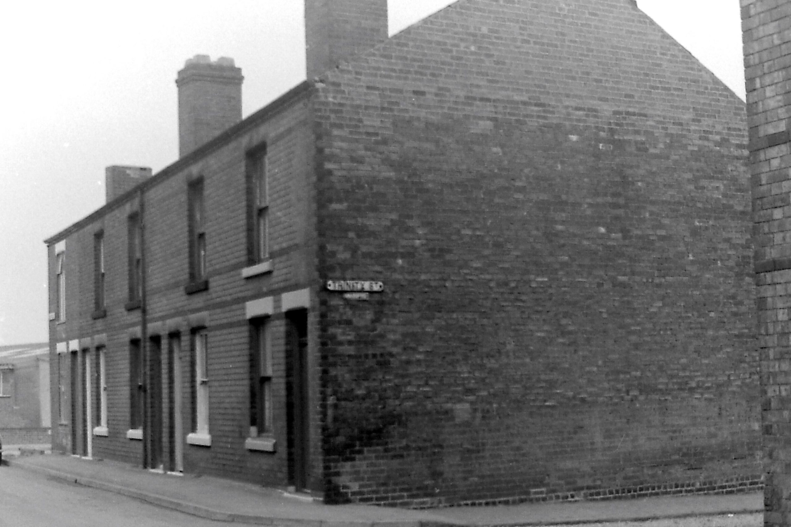
Durham Street west and its junction with Stamford Street
This is the opposite side of Durham Street with Stamford Street off to the right, during redevelopment.
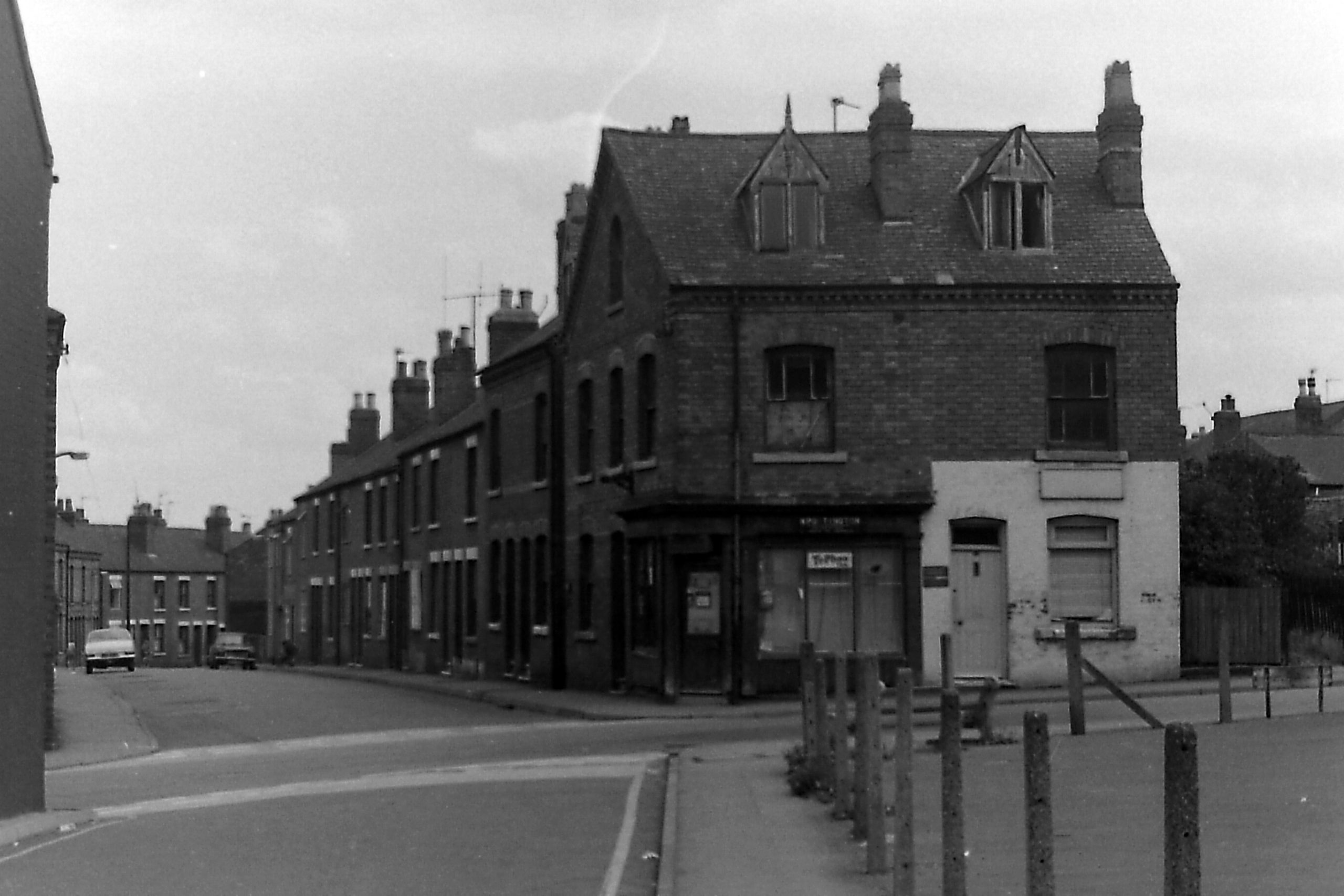
Ebenezer Street
The photo shows numbers 1 to 6, near the street’s junction with Awsworth Road (which is just out of view on the left edge), at the corner where the old Ebenezer Chapel was built in 1853.
Eyres Gardens
In the photo we are looking down Eyres Gardens, south-west to north-east, from Awsworth Road. The houses were developed in the late 1870s and 1880s.
The name is supposedly taken from the that of the Vicar of St. Mary’s Church at that time — John Francis Nash Eyre.
(Interestingly?) at the close of the Victorian era it was also the home of Annie Eyre, illegitimate daughter of ‘notorious’ George Clay Smith.
Gordon Street
Gordon Street (and other streets leading off from it) had just been laid out by the end of the Victorian era; no houses had yet been built there. All the houses you can see in the photo are post-Victorian.
Granby Street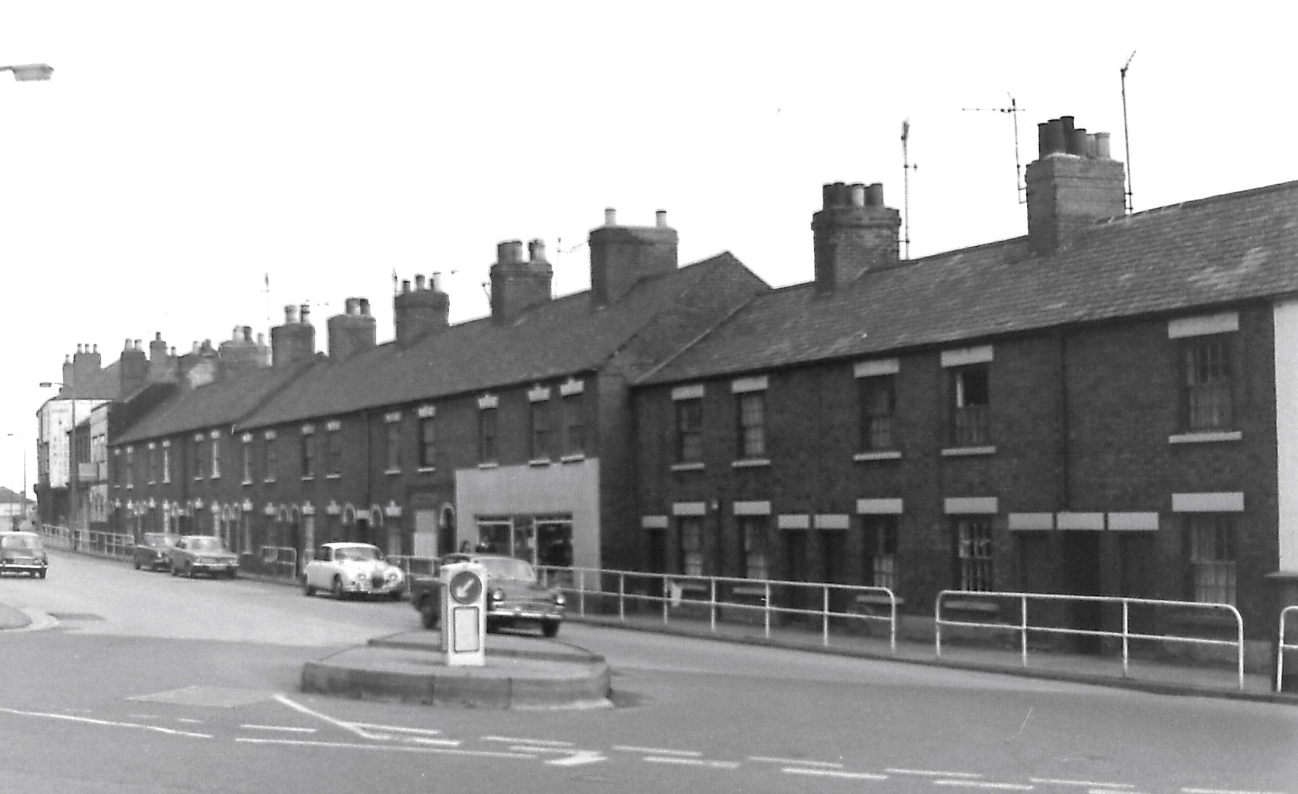
Here we are viewing the street from its junction with Bath Street/Heanor Road.
On the census of 1851 it went by the name of Middle Road but by 1861 Granby Street had appeared.
Grove Terrace
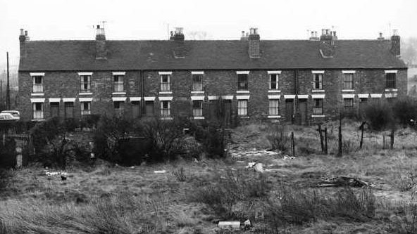
Also known as Spring Grove Terrace, this row of ten cottages gained a poor reputation (if it didn’t have one before) when the Blaxell Report of 1881 was published.
They stood next to the Ropewalk with the Erewash Canal as a close neighbour. The homes were demolished in 1968.
Hallam Fields Road
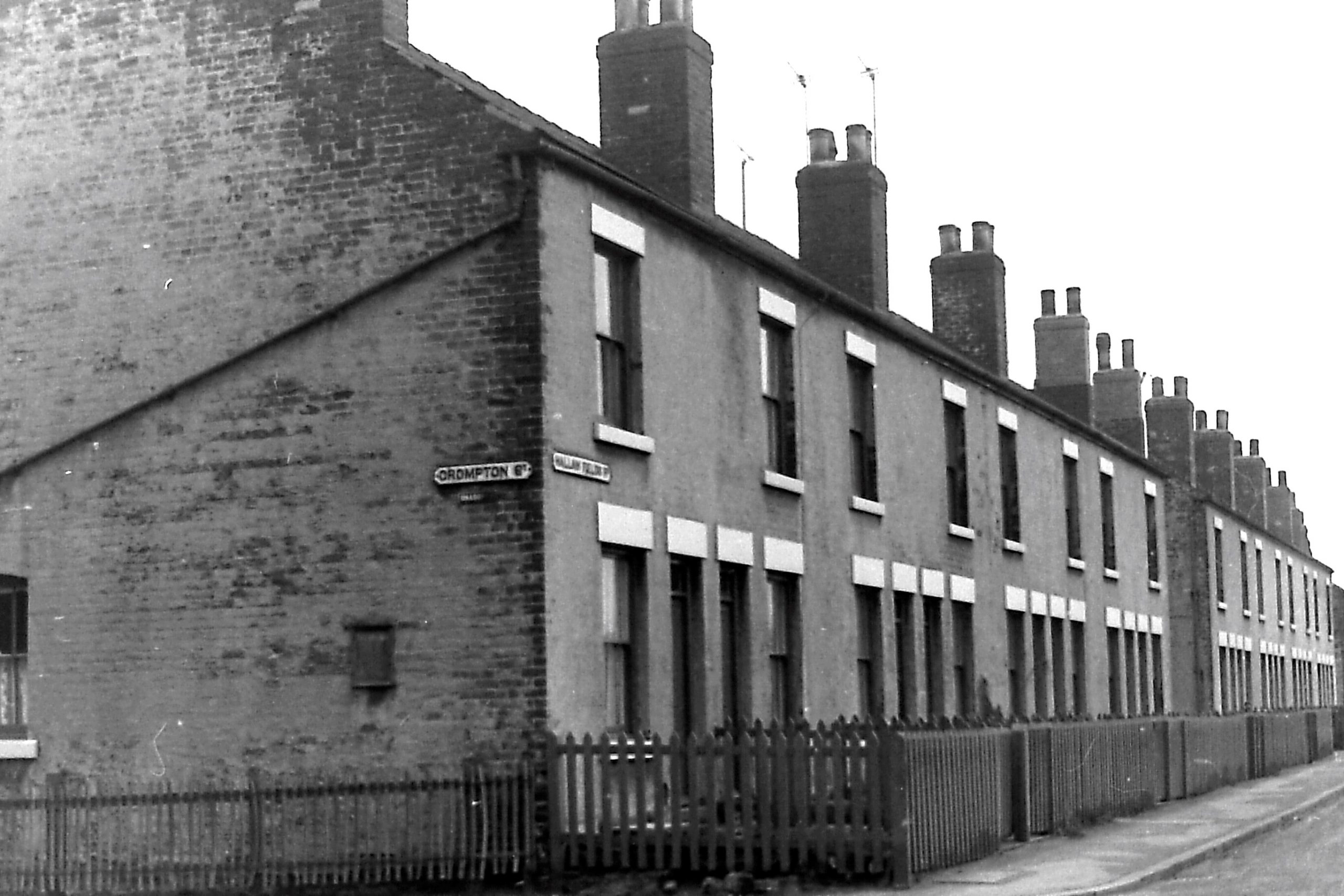
Access to the area of Hallam Fields began to be significantly (relatively) improved in the late 1880s when the Local Board (in its last days) approved the establishment of a new road into the district. This was subsequently developed as Corporation Street which later linked with Hallam Fields Road. These houses, at the corner with Crompton Street, were some of the first to be built, from the late 1860s. Crompton Street was renamed as Crompton Road in 1979.
On the 1881 census the houses appear as North View.
Heanor Road
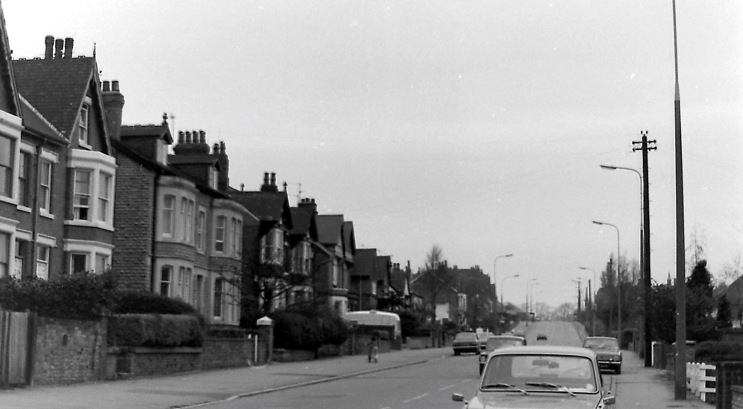
Established as a turnpike road from Ilkeston to Heanor from the 1760s onwards, the lower (southern) section of the road appears as Work House Hill on the 1841 Census. The houses in the photo are situated further north along the road, on its west side, an area developed from the end of the nineteenth century.
King Street
This is another part of the development of lower Station Road and the streets off either side, which occurred from the 1880s onwards. We are looking down King Street (towards the north) as it crosses Station Road — as Upper King Street becomes Lower King Street. In the distance we can see the houses of Mill Street.
At the top of King Street, on the left (west), we can see the large lace factory developed in the 1880s by the Maltby family.
Lawn Terrace
Along Pimlico and off the same lane was a collection of houses called Wheatley Row (see below, renamed about 1910 and referred to as Dorothy, Vernon and Haddon Cottages). Most of the Row stood on the west side of what is now a large car park at the side of the Scala Cinema (the large waste area on the photo). At the north end of the same car park once stood Lawn Terrace, a row of ten similar cottages developed at the end of the Victorian period.
In the early part of that same century this had once been part of an area of fields, gardens, orchards and nurseries known as the Lawn.
Lord Haddon Road
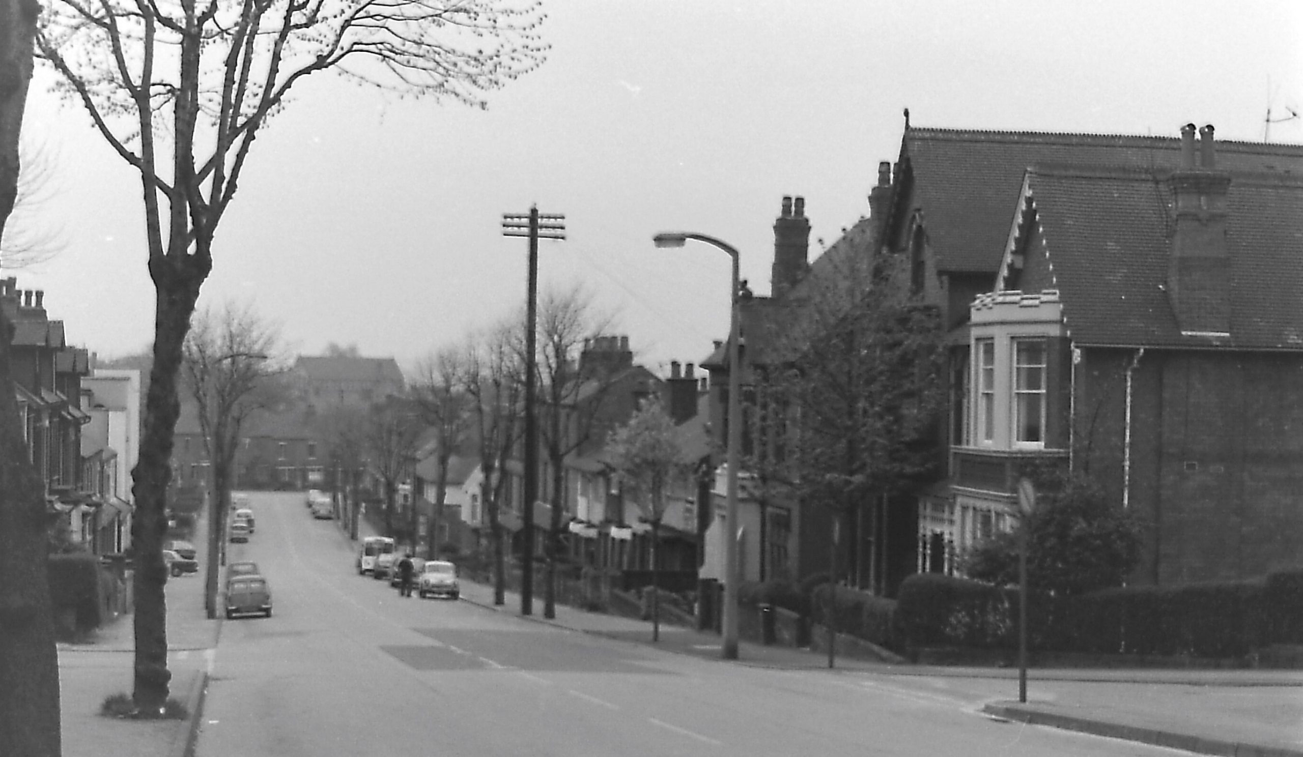
This initially private road was formally opened on September 25th, 1895. By April of 1897 sixty lime trees had been planted along its length, to commemorate sixty years of Queen Victoria’s reign.
The photo shows Fullwood Street joining on the right foreground and Nesfield Road on the left (west). Also on the left you can just glimpse the white, imposing structure of the ‘New Theatre‘.
In the distance, at the end of the road, are the houses of Manners Road.
Of course, not all the houses you can see were built in the Victorian era.
Manners Road
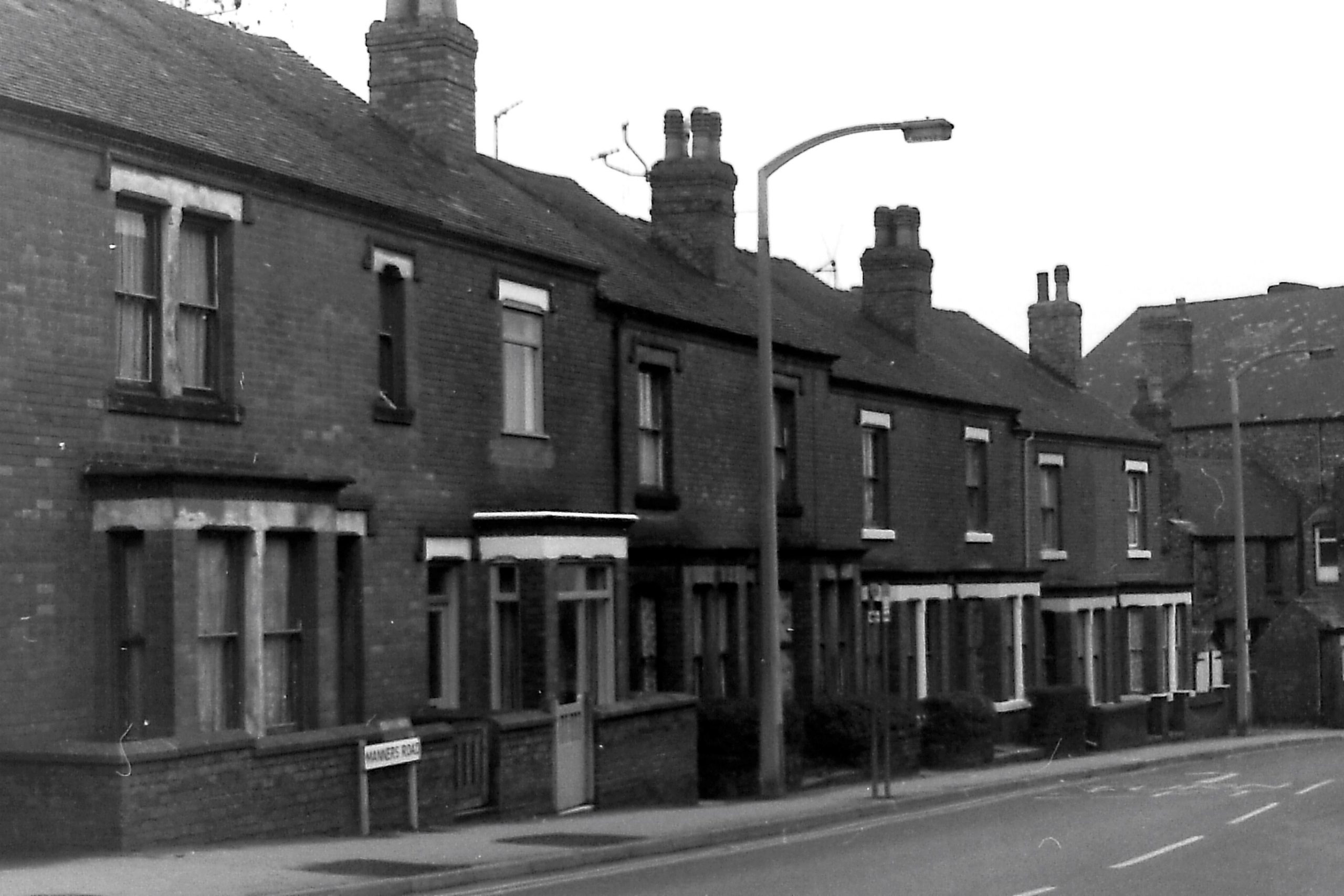
This road was glimpsed in the previous photo. These are the houses on the north side of the road as it approaches Bath Street (just off the extreme right). The old Manor Ground football ground stood on the left of the houses.
Market Street
The idea for this ‘new’ street from the Market Place to join with Nottingham Road, was mooted in 1853 and the street was complete ten years later. In the photo we can see where Gladstone Street crosses (left to right).
Mill Street

Mill Street runs, west to east, from the bottom (north) end of Wood Street to the Erewash Canal. In 1881 it didn’t exist at all — and nor did Wood Street. The area was covered by fields, and the only significant building was the flour mill adjacent to the canal. Serious development of the area began in the late 1880s and beyond the end of the Victorian era.
The photo shows the western end of Mill Street where a new block of flats in Wood Street has just been built.
Mitchell Terrace
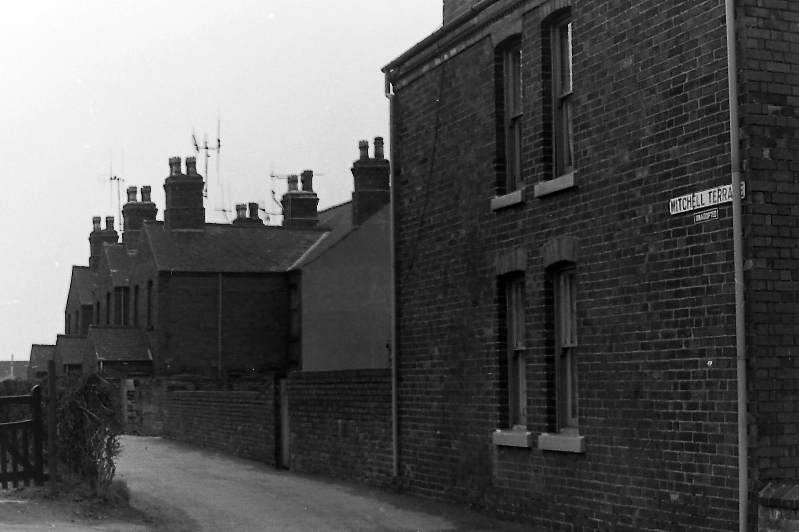
At the end of Victoria’s reign Mitchell Terrace was a row of six homesteads, taking its name from the outspoken grocer and Town Councillor Charles Mitchell who represented parts of Hallam Fields. The photo is taken from the Longfield Lane end of the terrace, the older part of the development.
Nottingham Road East
In the distance (north, with the three rounded-arch windows) is the Independent Mission Chapel, built in 1869-70. Most of the houses shown, built on this east side of the road, were erected at the end of the Victorian era.
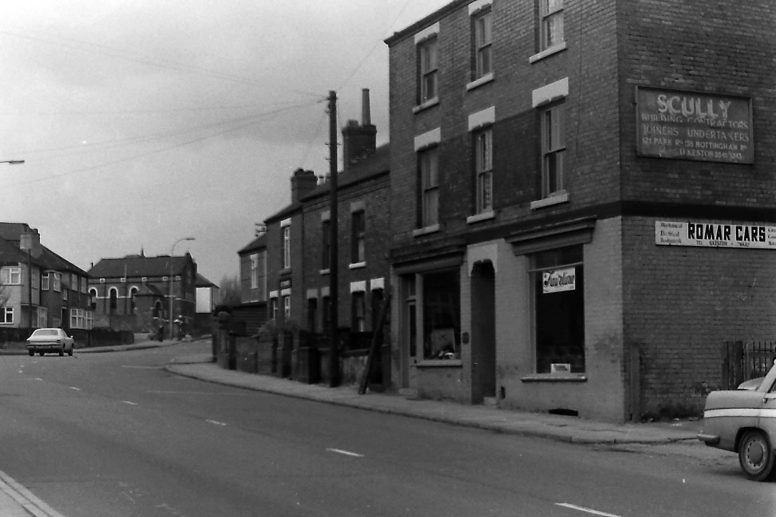
Nottingham Road West
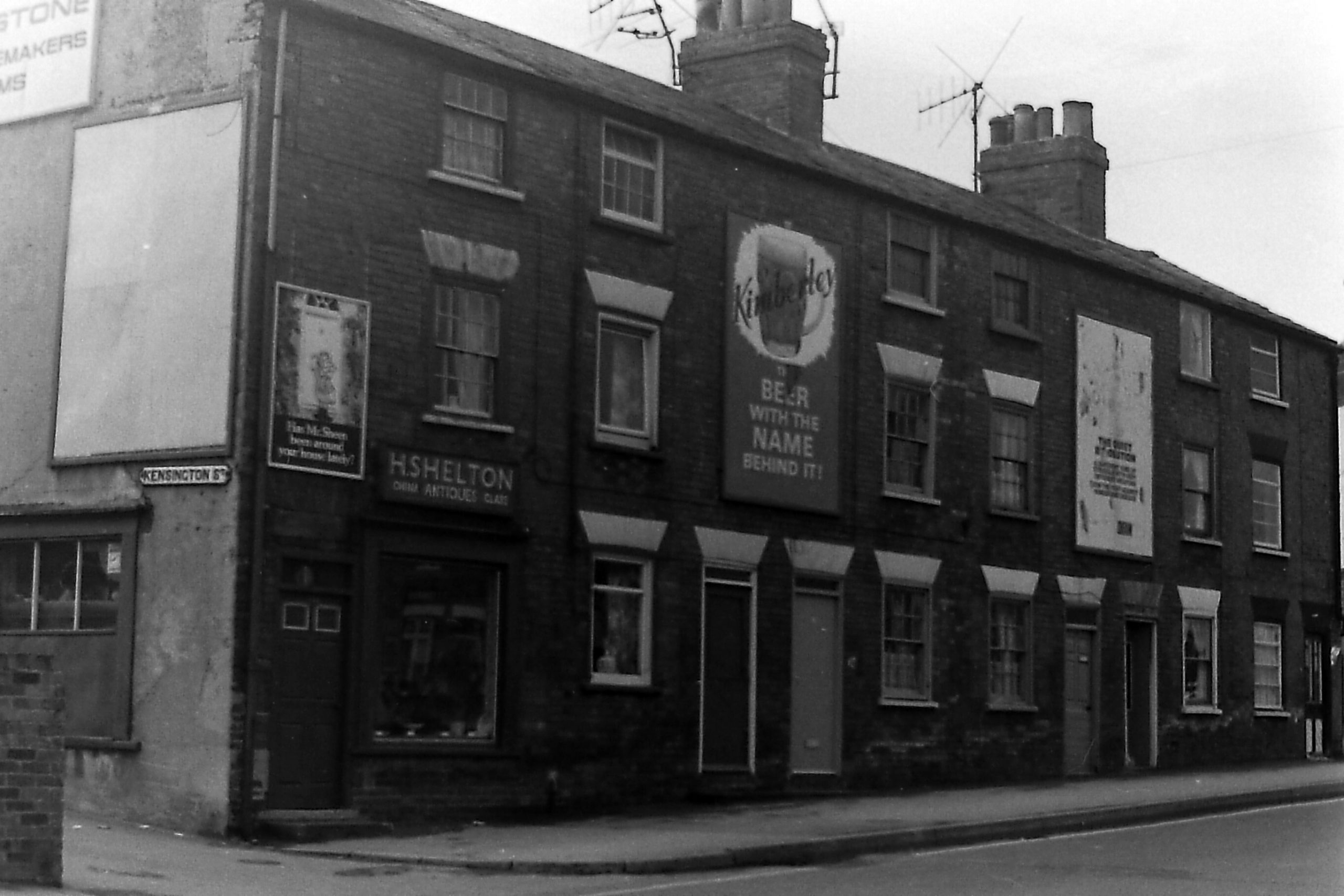
Opposite the houses shown in the previous photo, in this photo you can see the entrance into Kensington Street where stood the Needlmakers’ Arms Inn. This row dates from at least the 1860s.
Park Drive crossing Park Road and leading to Park Avenue
Park Drive had been planned in the late nineteenth century and construction began about 1892; as yet it didn’t join with Nottingham Road and had few houses along it. As the road crossed the older Park Road it became Park Avenue.
This photo shows the houses just as we have entered Park Drive from Nottingham Road, although in the far distance, at the end of Park Avenue, we can see the chapel attached to Park Cemetery.
The name ‘Park’ was chosen because all of this area was once part of “Ilkeston Park“.
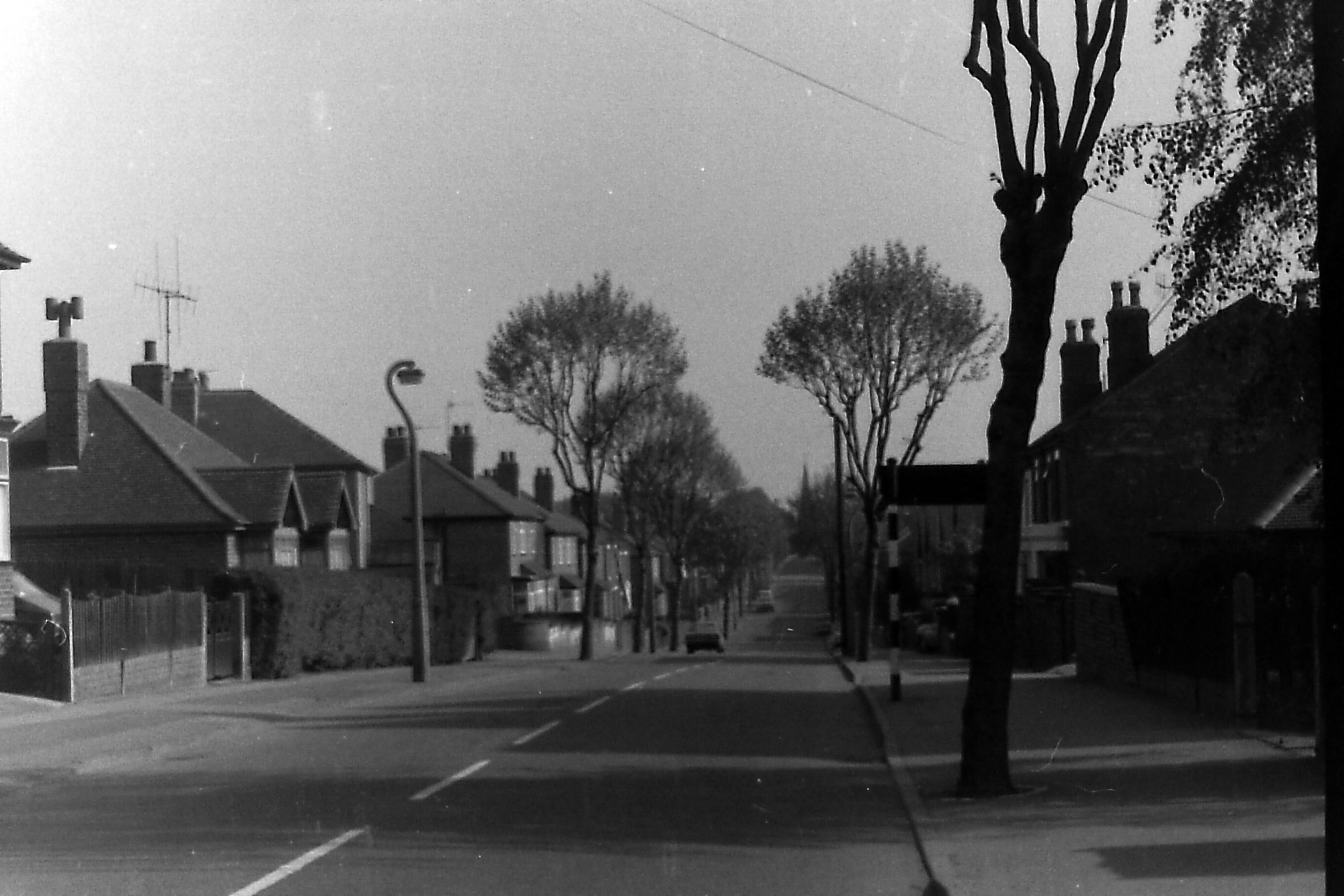
Pelham Avenue
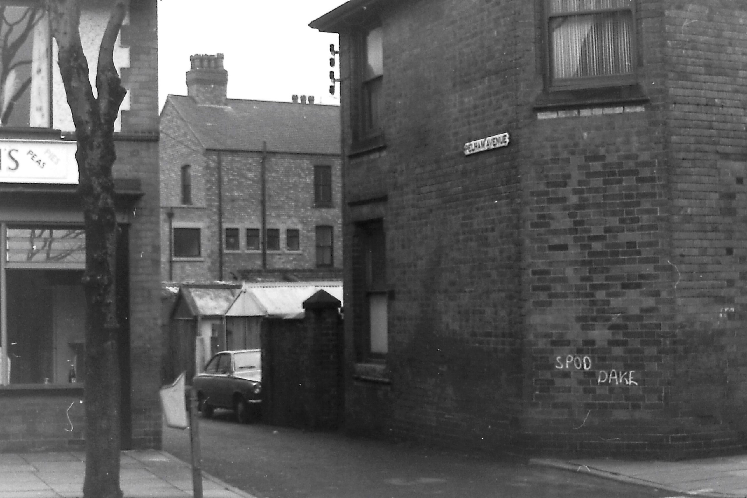
This photo shows the entrance to the avenue as it leaves the north side of Pelham Street. It reappears when it links to Manners Road. This was another late Victorian development.
Pimlico
The photo is of the north side of Pimlico, and these cottages were once part of Wheatley Row (see below). They stood on the west side of the Scala Cinema which is hidden from view, at the far end of the row. Part of the King’s Head Inn stands in the distance.
Prince Street
By 1881 Prince Street was well-established and generously populated. Here we are looking northwards towards Church Street.
Thorpe Street
This stands as a short cul-de-sac off the east side of Norman Street, between Archer Street and Charlotte Street, developed in the 1860s. It housed a maximum of a dozen families.
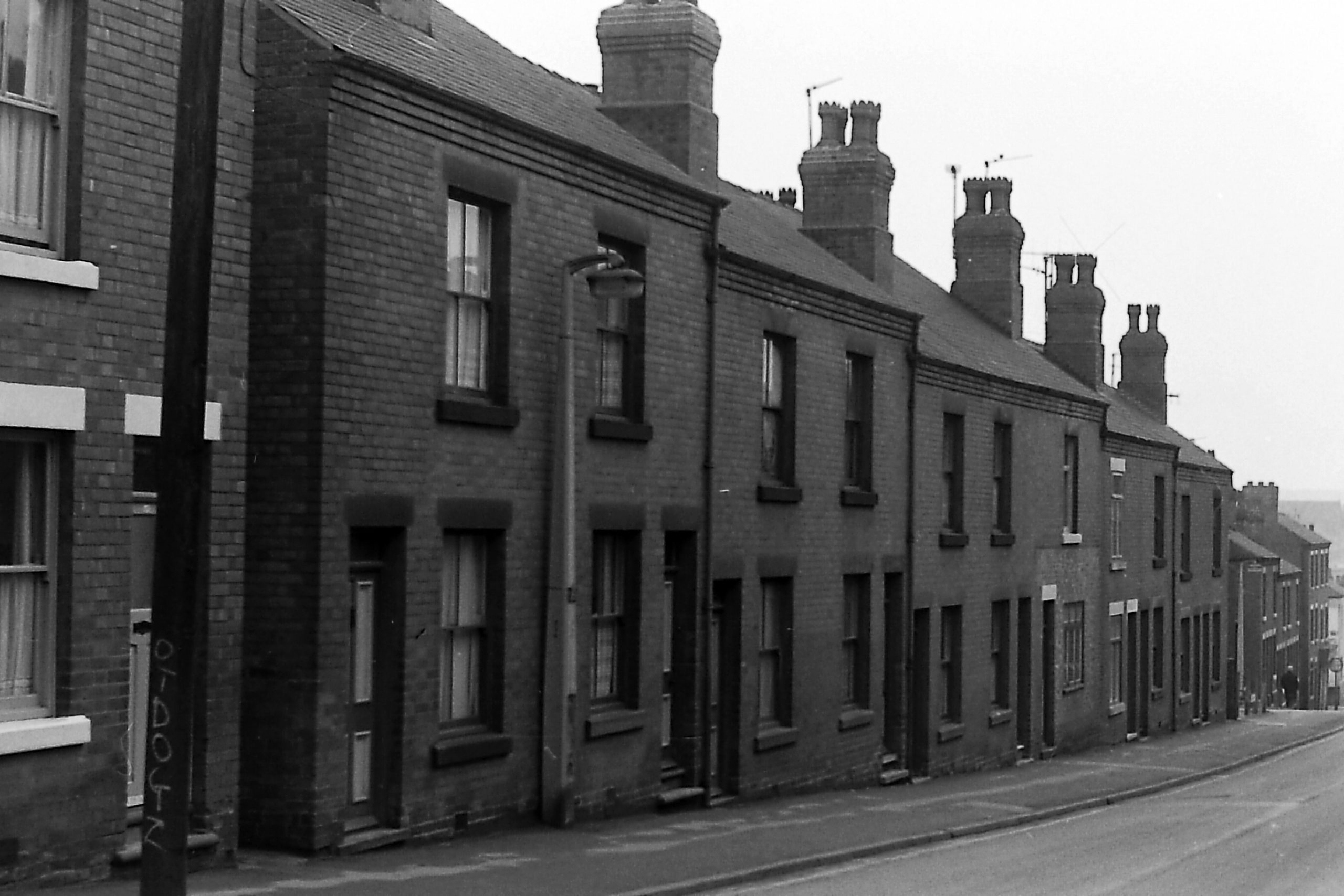
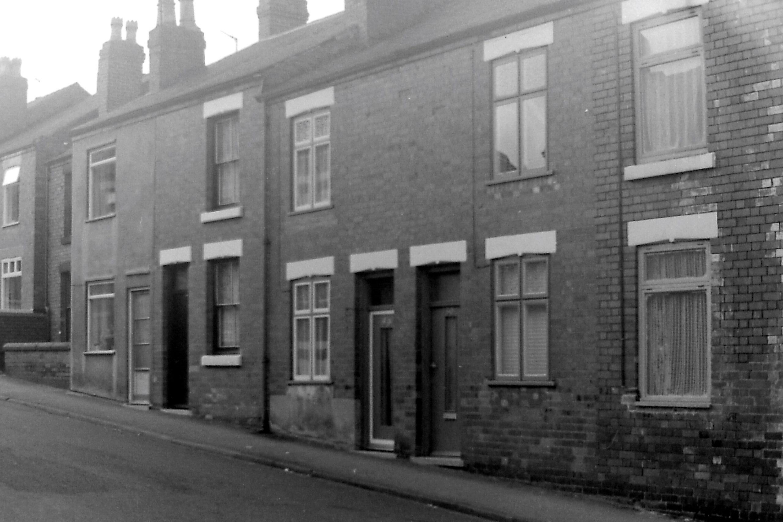
Union Road
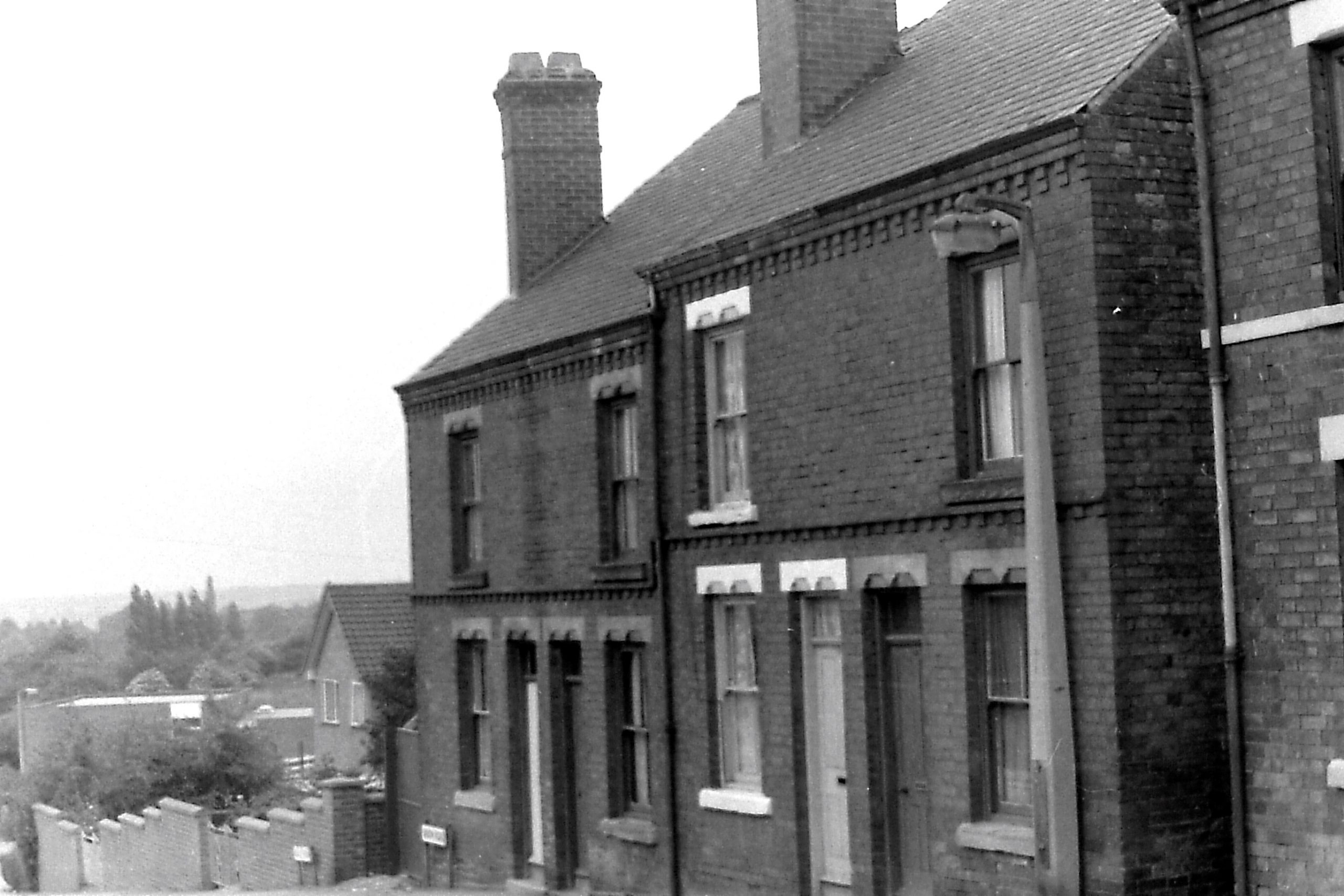
From Stanton Road, this road crossed Belper Street before it culminated in a dead-end. Today it continues as Dale View.
The part of the road to the east of Belper Street appears on the Local Board map of 1866.
In the photo you can see the last houses built in the original road at the end of the nineteenth century. Belper Street is off to the right.
Wheatley Row
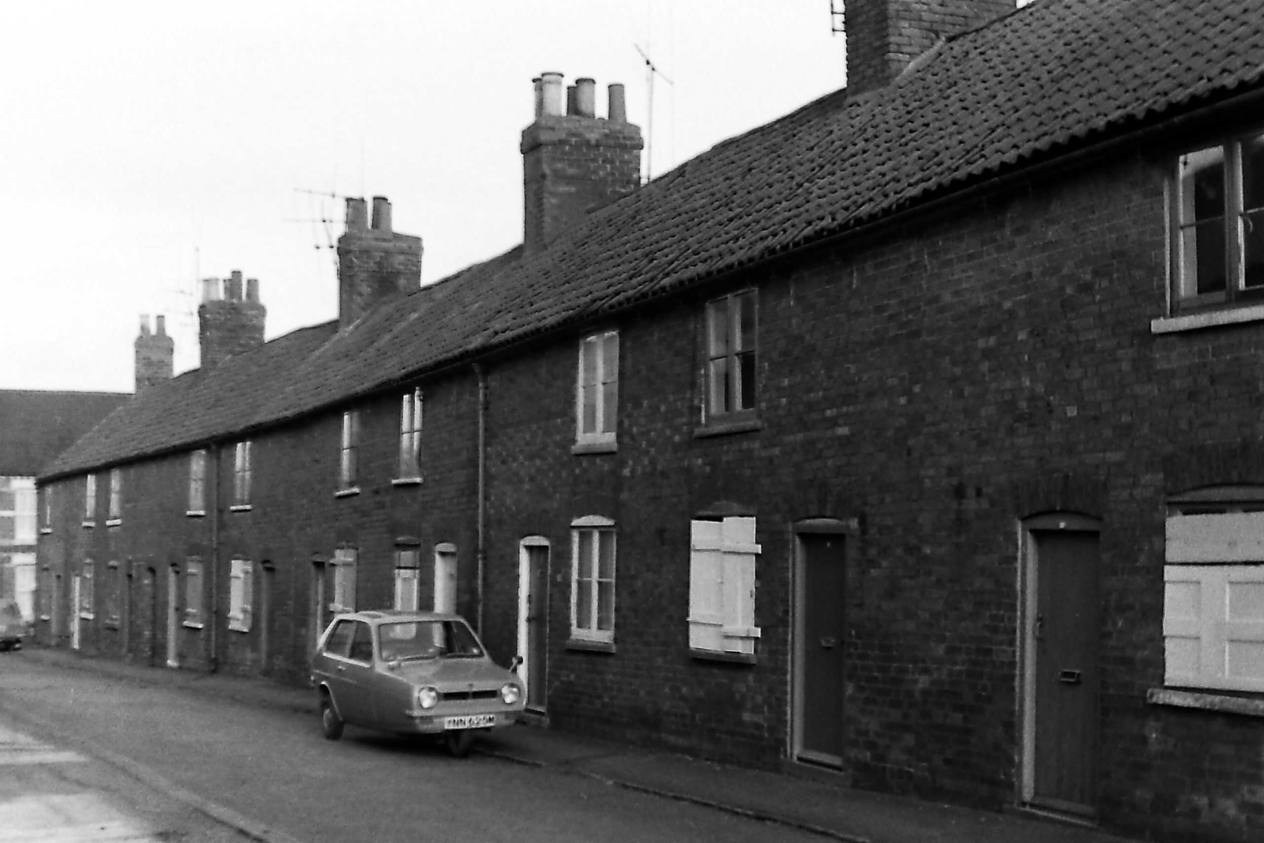
Known as Wheatley Row in the Victorian era, these cottages were renamed by their owner as Dorothy Cottages about 1910. They have now been demolished and replaced by a car park at the side of the Scala Cinema. Off to the left stands the Croft Yard Reservoir. (see Lawn Terrace above)
Wilmot Street
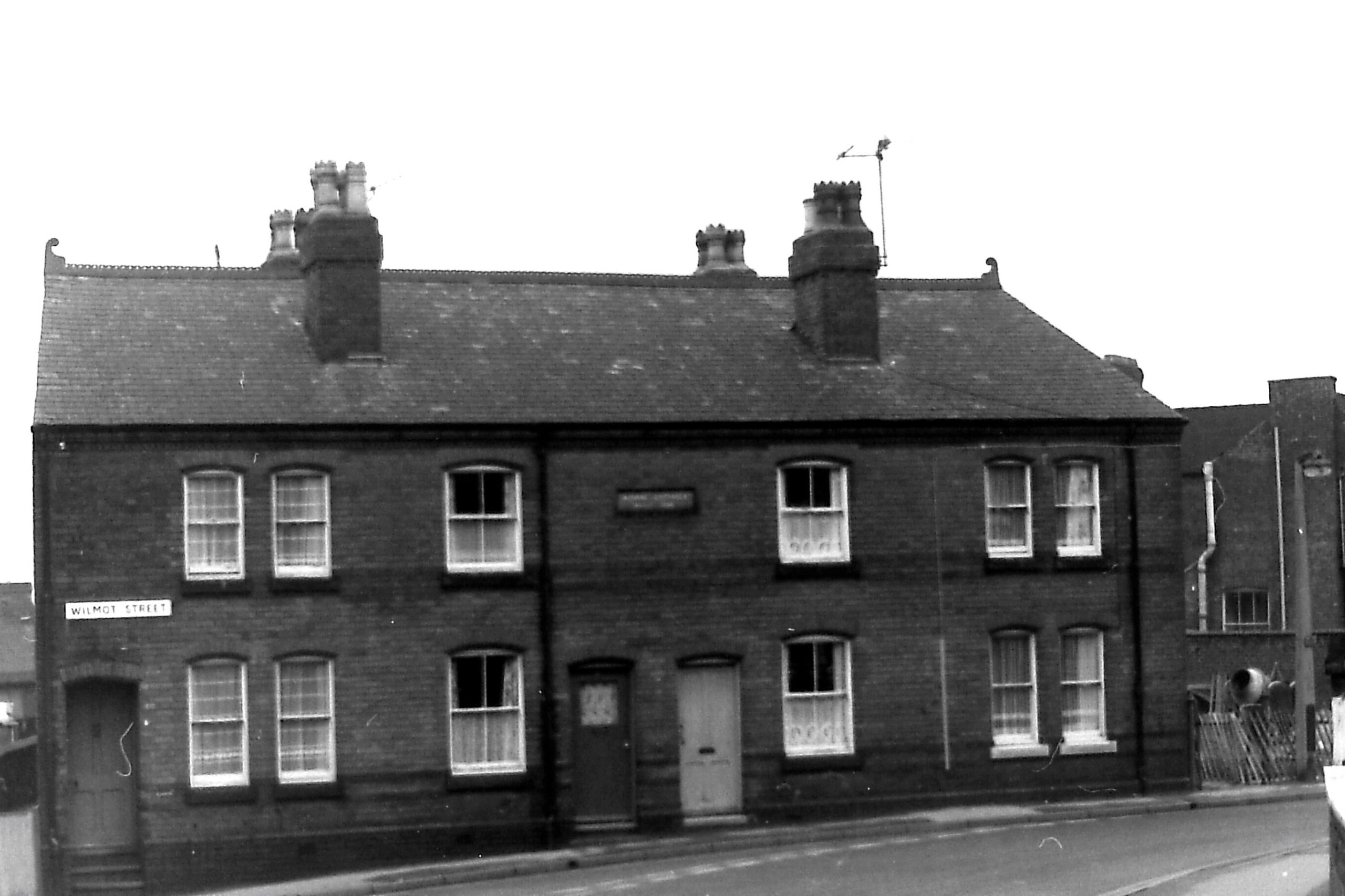
This part of Wilmot Street was previously known as Spring Lane, which also included part of what was later Fullwood Street. These houses (known as Bourne Cottages) stand between the Spring Cottage Inn (on the right, west) and the premises of St. Andrews Methodist Church.
______________________________________________________________________
Old Ilkeston Streets 1 and Old Ilkeston Streets 3
